To celebrate our official launch of Outer Sunset and Parkside coverage, we're taking you on a little trip back in time with our Then & Now feature, which examines the storied pasts of San Francisco's neighborhoods.
“The early residents of the Parkside confronted a land without streetlights or sidewalks, with more rabbits than people.”
--Richard Brandi and Woody LaBounty, San Francisco’s Parkside District: 1905 - 1957, Western Neighborhoods Project.
The Sunset first started taking shape in the era after the Outside Lands period, when San Francisco claimed the area that would become the Sunset and Richmond Districts in the 1850s.
Back then, the Sunset was mostly sand dunes—and rabbits. In the early days, a fun and practical activity for neighborhood kids was hunting for jackrabbits. Many of the rabbits they caught would end up on these Sunset settlers' dinner tables.
It would take nearly 100 years for the area to become fully developed—as late as the 1970s, the Sunset still had sand dunes. The last major sand dune is now the site of St. Ignatius College Preparatory School, at 2001 37th Ave.
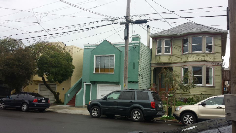
Vicente St. at 41st Avenue
In 1928:
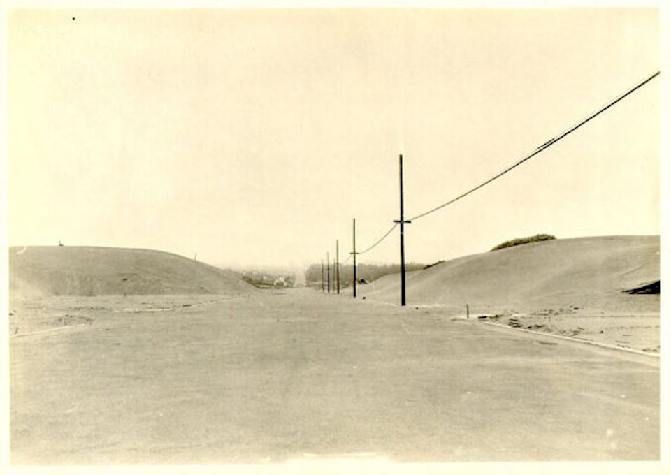 Photo: via SFPL
In 2016:
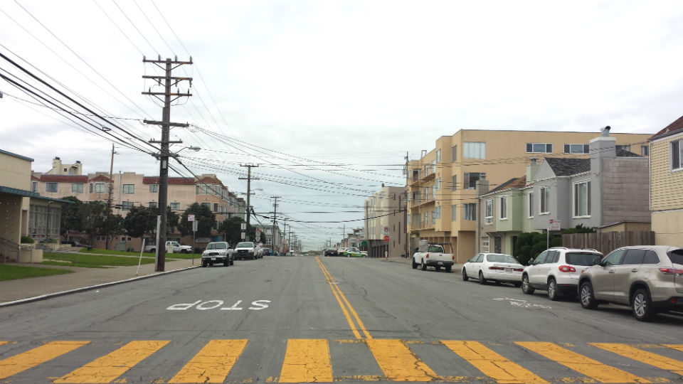
Today, the Ulloa Elementary School and residential homes make up 41st and Vicente. To find sand dunes, you'll have to go to Ocean Beach.
The Parkside Grocery, 32nd Ave. and Taraval St.
In 1908, Eugene Williams opened Parkside’s first grocery store, the Parkside Grocery, at 32nd and Taraval. Above the grocery, Williams Hall hosted community events and meetings of the Parkside District Improvement Club; Williams was also a member of this early civic improvement group.
Williams Hall was a lively place: it had its own gym and hosted talent shows, costume parties, and classes well into the 1920s.
In 1925:
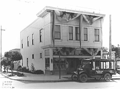 Photo: via Western Neighborhoods Project
In 2016:
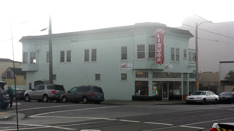
Gene’s Liquor Store has occupied the former Parkside Grocery space since 1997. It's carried on the tradition of feeding the local population by providing sandwiches made on-site.
Sunset Super, 25th and Irving
Then as now, Sunset Super was a popular market. The Falletti family ran Sunset Super from 1961 to 1997, when they lost their lease.
In 1951:
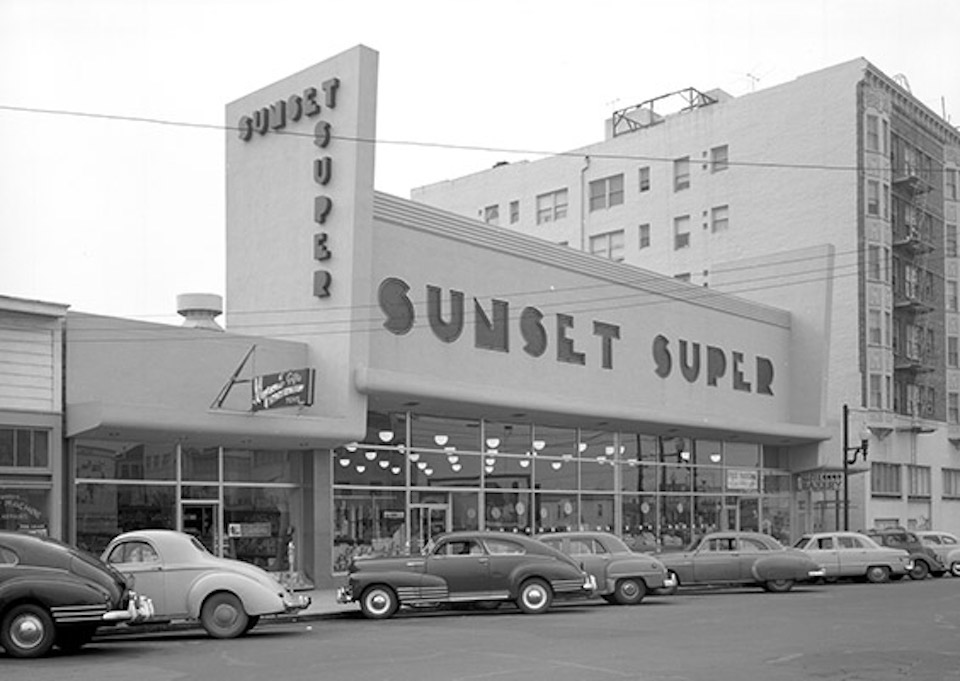 Photo: via SFPL
In 2016:
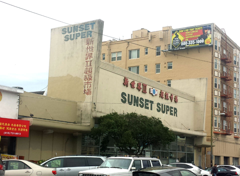
Sunset Super remains a popular destination in the Irving corridor. Reflecting demographic changes in the district, it’s now an Asian supermarket.
St. Andrews by the Sea Episcopal Church, 1338 47th Avenue
Carville was one of San Francisco’s most unusual neighborhoods: its dwellings were comprised of old horse-drawn railcars. The Market Street Railway Company eventually replaced them with newfangled electric streetcars. In 1895, the company sold them for “$20 with seats, $10 without.”
Enterprising San Franciscans moved out to what is now the Outer Sunset, turning the streetcars into homes, and Carville was born.
According to the Western Neighborhoods Project, St. Andrews by the Sea began life as a beachside retreat called Vista del Mar. It included two streetcars on the second floor.
In 1908-11:
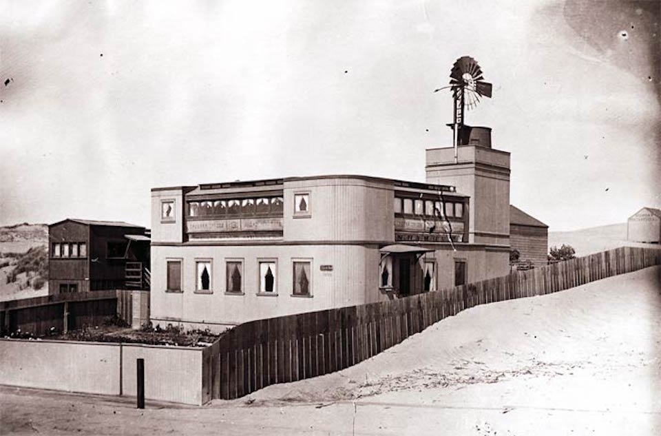 Photo: via Western Neighborhoods Project
In 2016:
The little church by the sea did not survive the changes wrought by the increasing development of the Sunset district. The area occupied by the church is now part of the residential district near Judah Street.
Carville itself faded away into memory by the 1920s. Today, the last remaining home from those adventurous days is at 1632 Great Highway.
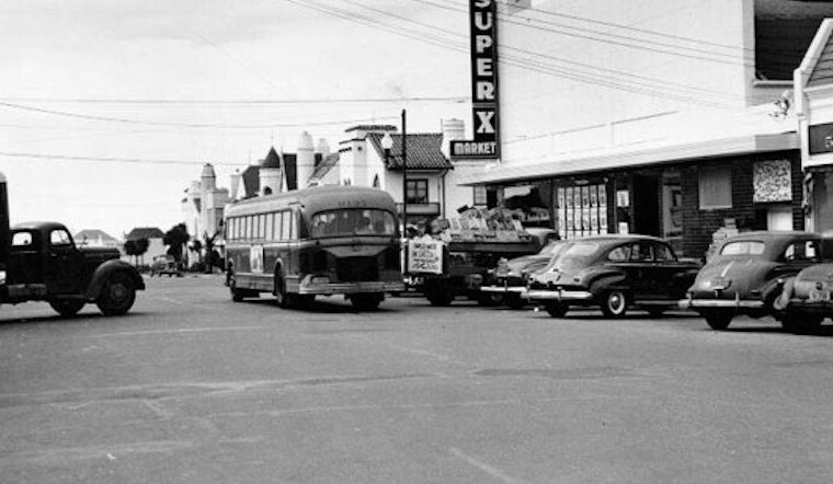
Noriega St. between 24th and 25th Avenues
Some things change, and some things stay the same—like complaining about delivery trucks blocking traffic.
The caption for this old photograph of Noriega St. between 24th and 25th reads: “Shown in this photo, looking west on Noriega-st from 24th-av, is a hazard common to the thoroughfare's several small shopping districts. A long truck, parked diagonally, so narrows the street space that with a Muni bus passing by, there is scarcely room for traffic headed the other way."
In 1951:
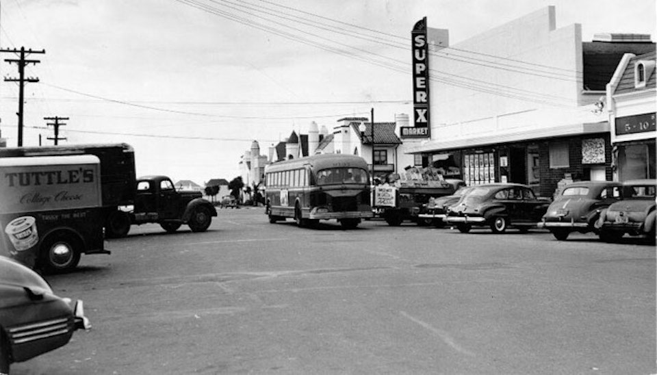
Photo: via SFPL
In 2016:

Today, the former Super X Market is now a Walgreens. And while the cars and Muni buses may look different, the traffic situation hasn’t changed much in the intervening years.
For more information on the history of the Sunset, explore the Western Neighborhoods Project and Found SF.


