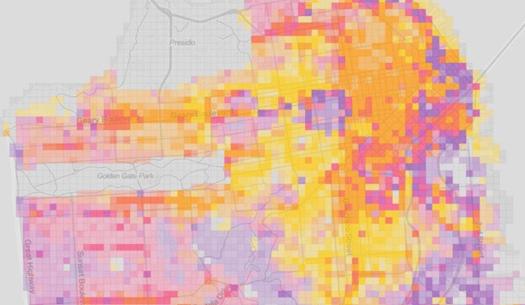
The National Trust For Historic Preservation recently released a brand new website that offers a very in-depth look into certain aspects of San Francisco.
Their maps use city data to compile maps covering median building age, number of businesses, persons per square mile, and more. If you're a visual person, this is a really great way to analyze at some key demographics regarding our city. We zoomed in to Divisadero, and here's some of what we learned...
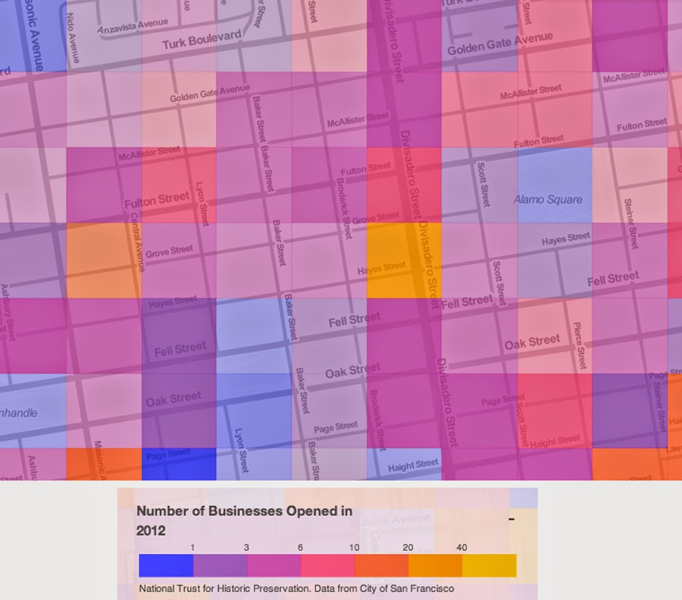
Based off the map above, you can see that certain areas of Divisadero were booming for new businesses in 2012. The colors don't quite correspond with the numbers in the chart (no, there were not 40 businesses that opened in the yellow square), but it does give one a general idea of what blocks were booming a couple years ago.
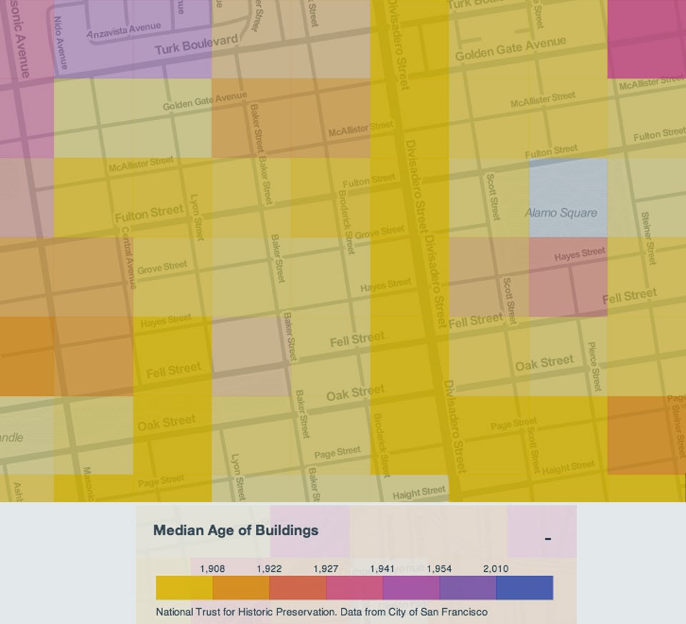
The median age of buildings in our neighborhood is old, old, old! The chart above breaks years down into thousands, but if you remove the commas you'll notice that most of the buildings in our neighborhood were build prior to 1908.
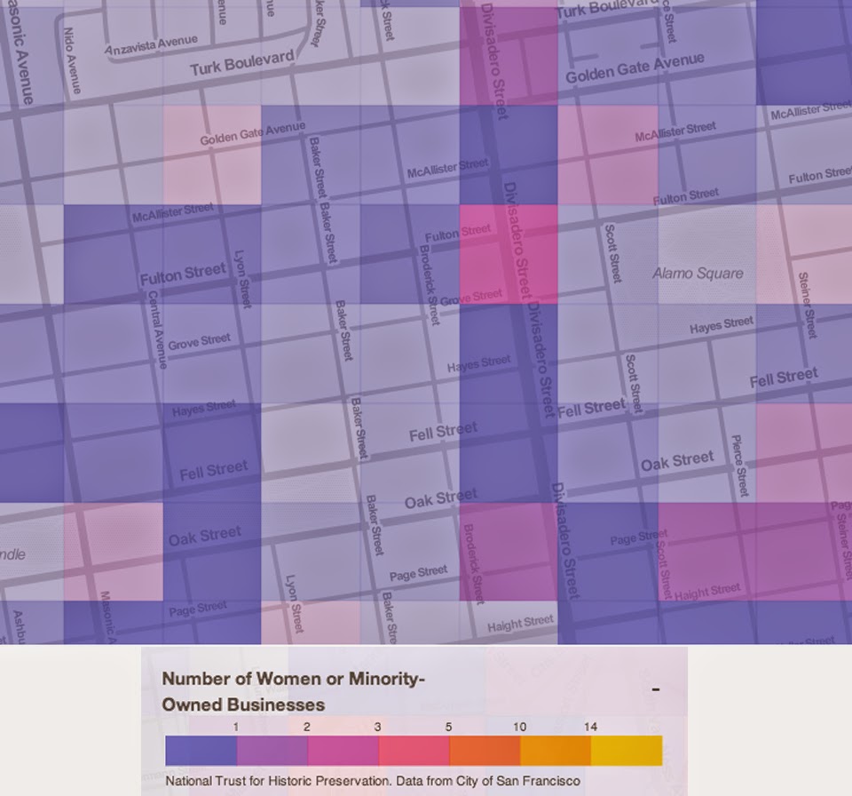
Finally, here's an interesting look at the number of businesses owned by women and / or minorities in our neighborhood. Compared to the rest of the city this is pretty on par with other neighborhoods, with exceptions of neighborhoods like Chinatown.
What do you think? Any surprises here? Since it is an interactive program we highly recommend heading on over to play with the site yourself. Let us know your thoughts in the comments.


