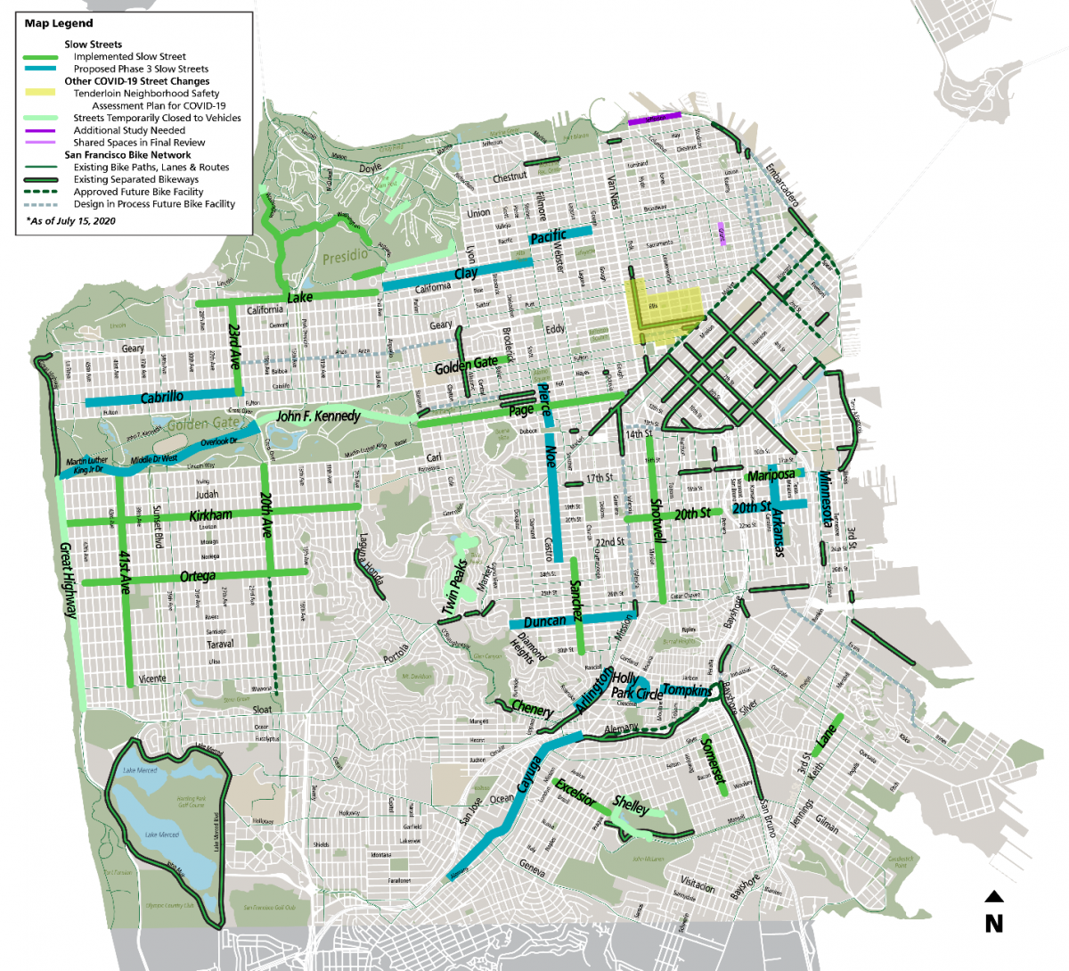
On Thursday, the San Francisco Municipal Transportation Agency (SFMTA) announced the expansion of its Slow Streets program. 14 new corridors will be up for approval with the SFMTA board of directors next Tuesday.
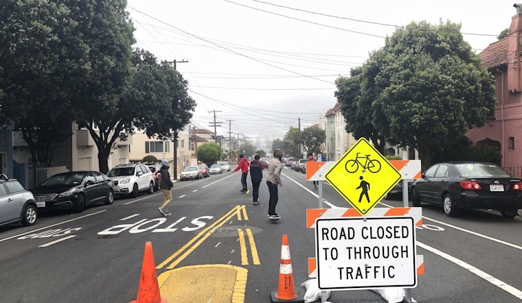
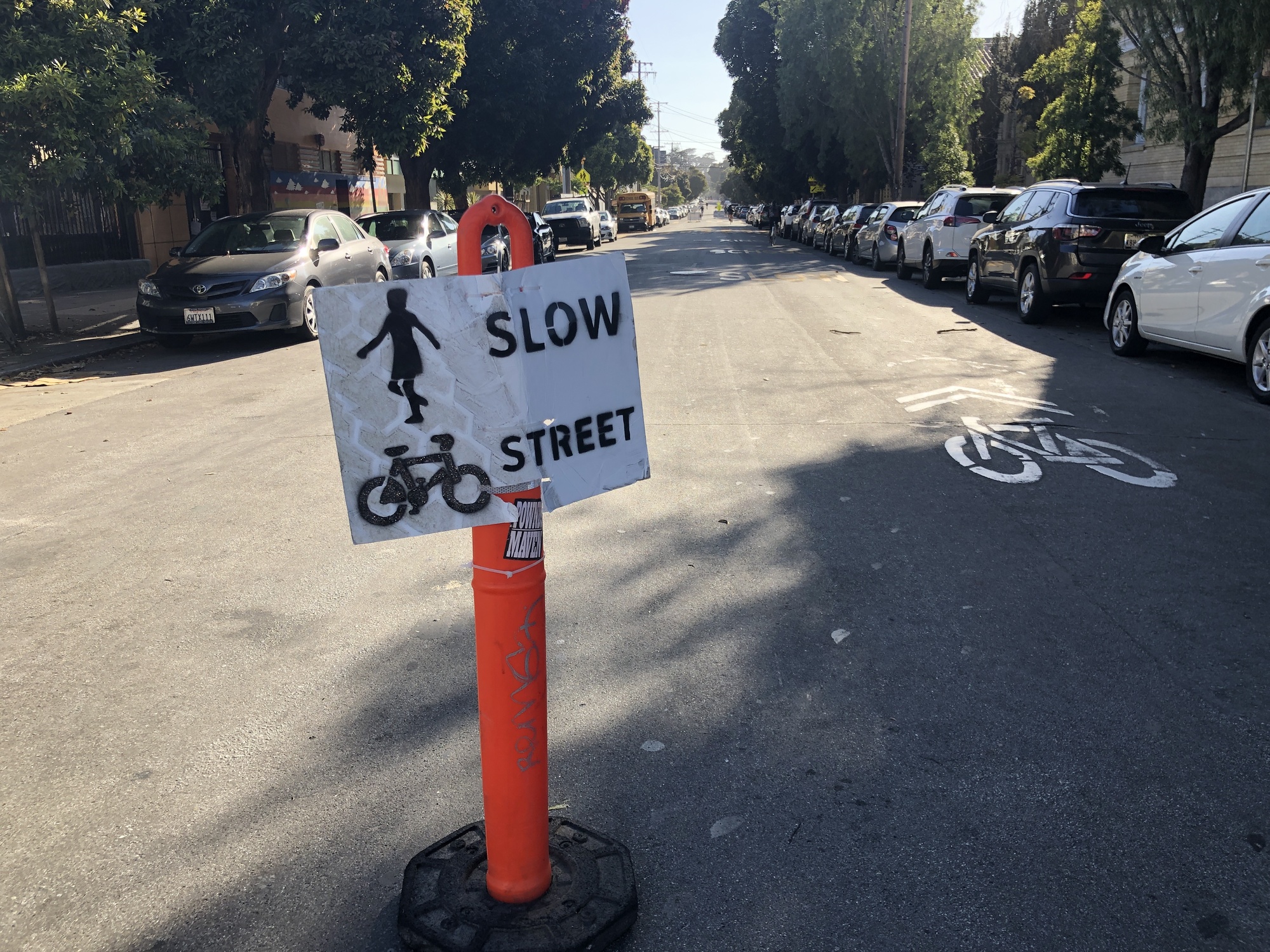
In April, SFMTA announced the agency would close select streets to vehicular traffic, in order to provide more space for pedestrians and cyclists to socially distance during the shelter-in-place order. SFMTA staff also said they hope Slow Streets will provide better bike and pedestrian networks as transit capacity remains significantly reduced.
"In order to support further reopening of the economy, we need to make San Francisco more welcoming and accessible for people who want to travel on foot, bicycle, wheelchair, scooter, skateboard or other forms of micromobility,” Jeffrey Tumlin, SFMTA's director of transportation, said in a statement.
Here is a list of the proposed street closures:
- 20th Street (from San Bruno to Pennsylvania)
- Arkansas Street (from 23rd to 17th)
- Arlington Street (from Roanoke to Randall)
- Cabrillo Street (from 45th to 23rd)
- Cayuga Avenue (from Naglee to Rousseau)
- Clay Street (from Arguello to Steiner)
- Duncan Street (from Diamond Heights to Tiffany)
- Holly Park Circle
- Mariposa Street (from Texas to Mississippi)
- Minnesota Street (from Mariposa to 22nd)
- Noe Street (from 23rd to Duboce)
- Pacific Avenue (from Steiner to Gough)
- Pierce Street (from Hayes to Duboce)
- Tompkins Avenue (from Andover to Peralta)
"Excited that the latest round of Slow Streets will now add Holly Park Circle and Tompkins Street in Bernal to the ones already in place in the Mission and the Portola," District 9 Supervisor Hillary Ronen, who represents those three neighborhoods, said on Twitter.
In addition to the new Slow Streets, the proposal also suggests closing parts of MLK Drive, Overlook Drive and Middle Drive West on Golden Gate Park’s west side to cars to connect to JFK Drive on the east side. JFK Drive has been closed to vehicles since April after weeks of lobbying by pedestrian and cyclist advocates.
This will "create a safe and connected route for walking and biking from Ocean Beach to Market Street," District 4 Supervisor Gordon Mar, who represents the Outer Sunset, wrote on Twitter.
Golden Gate Park is "an oasis for socially distant recreation," Rec & Park general manager Phil Ginsburg said. "I am thrilled this phase of Slow Streets extends a car-free path of travel all the way to the ocean."
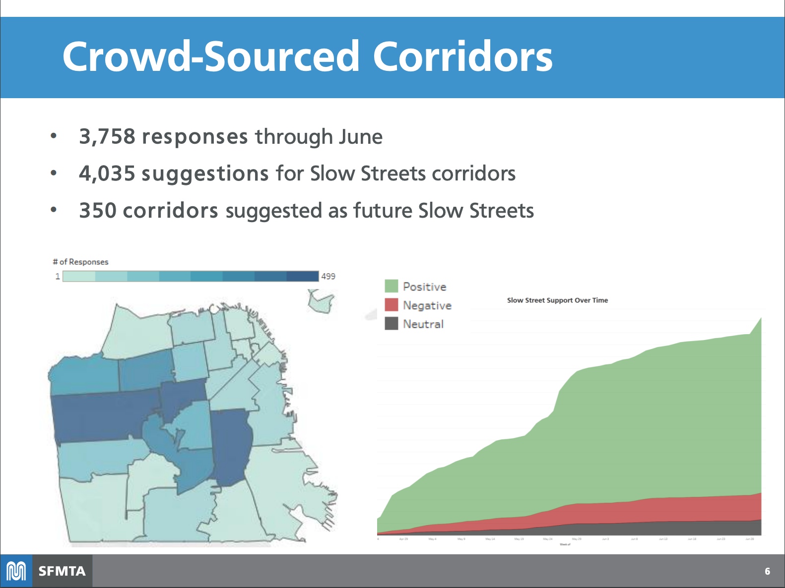
SFMTA Representatives also noted in a blog post that survey data indicates an 80 percent approval rating for Slow Streets. "These [additional corridors] will help give us the room we need to walk, run, cycle, play, and gather safely," Ronen said.
However, dense neighborhoods of the city, including North Beach, SoMa and the Tenderloin, still experience crowded sidewalks but remain without Slow Streets.
District 6 Supervisor Matt Haney, who represents SoMa and the Tenderloin, said last month that these neighborhoods "were unfortunately mostly left out of Slow Streets program, despite my objections, due to the complicated nature of our streets and high traffic."
District 3 Supervisor Aaron Peskin, whose district includes North Beach, cited the "hilliest and transit-densest" streets as the "chief obstacles."
"Push on the SFMTA board and city leaders to expand Slow Streets to the Tenderloin and other neighborhoods that would benefit from additional space on our streets to move about safely," representatives of the San Francisco Bicycle Coalition countered. "This program will only be a success if it’s designed with all neighborhoods and all San Franciscans in mind."
Last weekend, District 3 supervisor candidate Danny Sauter posted a photo to Twitter with a closed section of a street in his neighborhood. He said he and his neighbors closed it themselves, "since [the] city can't seem to figure it out."
It can and it should. But let's be honest and call out failures like District 3 not having a Slow Street, despite being densest part of SF.
— Danny Sauter for Supervisor 李爾德 (@DannySauter) July 14, 2020
I created one w/ my neighbors this weekend since city can't seem to figure it out. pic.twitter.com/uRwpWLGjQg
The next step will be installing additional barricades on current Slow Streets as more equipment becomes available, and beginning installation of new Slow Streets corridors if approved by the board.
Implementation of the new Slow Streets will continue through October, according to a presentation prepared for next week's board meeting.


-1.webp?w=160&h=400&fit=crop&crop=edges)

