Austin is bracing for a day of weather mayhem as forecasters predict severe thunderstorms, capable of producing large hail, damaging winds, and even isolated tornadoes throughout the day and into the night. There's a 50 percent chance of storms before 4 p.m., with possible patchy fog and new rainfall amounts reaching up to three-quarters of an inch, according to the National Weather Service.
Multiple rounds of showers and storms are forecast through early Wednesday with severe storms possible with any of these rounds. Main message today is to stay weather aware and have a way to receive warning information if a severe storm does near your location. #txwx pic.twitter.com/iRsYGObixt
— NWS Austin/San Antonio (@NWSSanAntonio) April 9, 2024
Compounding the tumultuous weather forecast, conditions could take a turn for the worse overnight. "Some of the storms could be severe," as per the National Weather Service, predicting a continuous chance of showers and storms between 7 p.m. and 4 a.m., with lows hovering around 60 degrees. In an advisory, the chance of precipitation is 50%, with potential new rainfall amounts falling between a quarter, and half an inch.
The KXAN reported a strong low-pressure system as the culprit behind the severe weather outbreak, giving rise to "plenty of instability, moisture, and lift" in the atmosphere. Communities are being urged to stay vigilant and keep abreast of the latest weather updates, as the possibility of isolated flash flooding looms with heavier showers potentially dumping 1"-2" of rain in a short span.
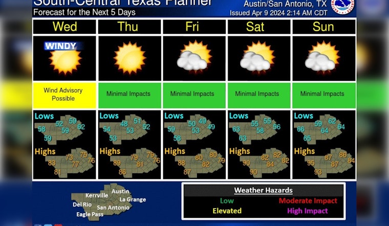
Residents are advised to download the KXAN Weather App and keep their devices ready to receive crucial updates as storms rage on. "Have a way to get important weather information between now and early Wednesday," in a statement obtained by KXAN. Relief should come by Wednesday morning with a forecast of sunny skies and a high nearing 76 degrees, but bracing winds with gusts reaching up to 35 mph will follow on the heels of the storm, stoking concerns about fire weather conditions for areas missing out on today's rains.


