The National Oceanic and Atmospheric Administration (NOAA) has officially declared the arrival of El Niño, a climate phenomenon characterized by warmer sea temperatures and significant impacts on global weather patterns. As NOAA predicts this El Niño event to strengthen by late fall and through spring, various locations worldwide are expected to face heavier rainfall and droughts. The question now is: what does this mean for the Bay Area and other regions of the United States?
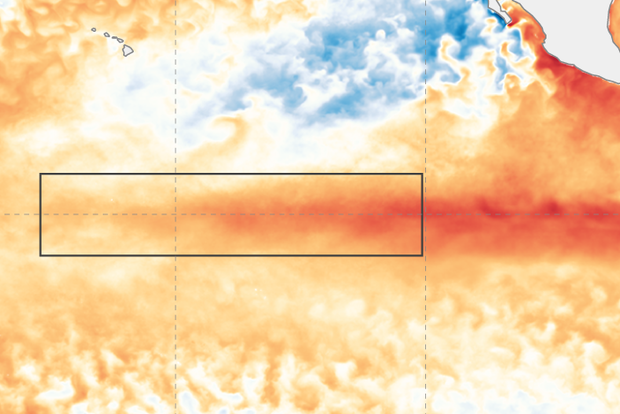
According to the NOAA, the United States will experience weak El Niño effects during the summer; however, the impacts are expected to become “more pronounced” as we approach late fall and spring. Climate scientist Michelle L'Heureux from the Climate Prediction Center states, “Depending on its strength, El Niño can cause a range of impacts, such as increasing the risk of heavy rainfall and droughts in certain locations around the world” via The San Francisco Chronicle. Moreover, climate change can amplify El Niño's effects, contributing to record temperature highs in various regions.
In light of the possibility of a greater-than-moderate-strength El Niño this winter, NOAA foresees an 84% chance and, more specifically, a 56% chance of it becoming a strong phenomenon. Axios reports that, as a result of the El Niño, 2023 or 2024 could witness a new record for the warmest year, surpassing the previous record set in 2016. These warmer ocean temperatures, coupled with climate change, could lead to an increase in global average surface temperatures as well as a higher prevalence of weather extremes like heatwaves, droughts, floods, and hurricanes via Axios.
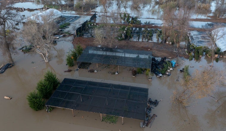
Regarding the Bay Area, El Niño's arrival indicates the potential for another wet year. El Niño events generally imbue the West Coast with more low-pressure systems, leading to increased rain clouds and potentially wetter conditions in California. The Gulf Coast, southern California, and even Northern California could experience above-average rainfall due to the El Niño phenomenon, while the Pacific Northwest and Ohio Valley may face drier conditions. Furthermore, El Niño-driven changes could result in above-average temperatures in the northern regions of the United States.
In addition to weather patterns, El Niño's presence will influence the 2023 hurricane outlook, suppressing hurricane activity in the Atlantic Ocean while enhancing it in the central and eastern Pacific basins. However, it's essential to note that El Niño's progression and impacts this time around may be uncertain and potentially more significant due to the rapidly warming planet influenced by human emissions of fossil fuels.
As the global community observes El Niño and its potential consequences, experts express concern for the health of marine ecosystems. With record-breaking ocean temperatures already in play, the additional ocean warming due to the El Niño event could have adverse effects on marine life, particularly coral reefs that continue to recover from the previous El Niño-related marine heatwaves.


