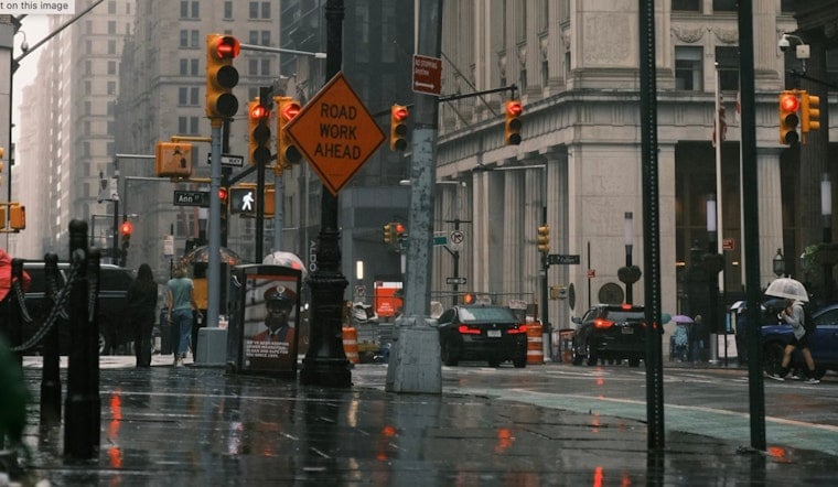
New York City is slogging into Friday, Feb. 20, 2026 under clouds, drizzle and temperatures hovering near 35°F, with a steadier rain moving in just in time to gum up the morning commute. A chilly northeast breeze will keep it feeling colder than the numbers on the thermometer.
Rain Through Friday; Wet Commute Ahead
Rain is expected to spread across the city late this morning into the afternoon, turning into a mostly gray, soggy day. The high should land near 42°F, with new rainfall totals generally between a quarter and a half inch.
Northeast winds around 10 to 14 mph will keep showers going at times and could gust to about 20 mph. Reduced visibility and slick roads may slow both the morning and evening rush, so commuters should expect some extra headaches on the way to and from work.
Out on the water, Small Craft Advisories remain in effect. Boaters can expect 5 to 6 foot seas and gusty east winds that will stick around into tonight.
Weekend Snow Threat Grows
Attention is already shifting to the second half of the weekend as confidence grows that a coastal low could bring accumulating snow Sunday into Monday, from Sunday, Feb. 22 through Monday, Feb. 23, 2026. The most intense snow bands are currently projected for Sunday afternoon through Sunday night.
According to the National Weather Service, the official outlook keeps most of New York City in the 1 to 3 inch range. Forecasters, however, note roughly a 30 to 40 percent chance that a heavier, more disruptive 6 inch or greater snowfall could materialize for Long Island, New York City and northeast New Jersey, depending on the exact path of the storm.
Strong northeast winds are also on the table, along with a risk of coastal flooding Sunday night into Monday if the low hugs the shoreline.
Plan Ahead
For Friday, an umbrella and patience are your best bets. Allow extra time on trains and buses, where wet platforms and slippery bridge decks can slow rush hour to a crawl.
If you have travel scheduled Sunday or Monday, keep a close eye on updated forecasts and transit alerts. A relatively quick flip to heavier snow could turn roads and sidewalks slick in short order.
Our Coverage
We flagged this coastal setup earlier in the week. For more context on how this storm pattern developed, check out our previous forecast piece NYC braces for coastal coating. We will update this story as the National Weather Service and local officials refine the timing and potential impacts.


