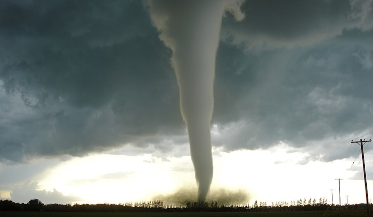
An EF-1 tornado tore across Defiance on Saturday afternoon, snapping big trees and ripping shingles from roofs as it carved a track of more than four miles through the city. National Weather Service survey crews confirmed the twister, which nudged Ohio’s 2026 tornado total up to 10.
Survey teams estimated peak winds near 95 mph, with a path about 4.08 miles long and a maximum width near 225 yards, according to the National Weather Service. Forecasters say the circulation spun up on the southwest side of town around 2:18 p.m., stayed on the ground for roughly six minutes, and lifted to the northeast. No fatalities or injuries have been reported.
Trail of damage through downtown
Survey crews documented heavy tree damage and snapped trunks near Davidson and South Clinton Street, along with minor to moderate roof damage to a church, a bank and the local post office, per WTVG. The circulation then pushed into downtown, crossed the Maumee River in a sequence caught on video reviewed by surveyors, and left scattered damage in neighborhoods north of the river.
Second touchdown in Defiance County this week
This marks the second confirmed tornado in Defiance County in about a week. The NWS documented a brief EF-1 that touched down southeast of Hicksville on March 31, with estimated peak winds near 95 mph and a path of roughly 2.71 miles. The back-to-back confirmations have kept survey teams busy across the county, NWS Northern Indiana noted.
Where Ohio stands
The Defiance twister has been counted as Ohio’s 10th tornado of 2026, WHIO reports. Ohio set a state record in 2024 with 74 confirmed tornadoes, according to The Columbus Dispatch, and logged roughly 28 confirmed tornadoes in 2025, per NBC4/WCMH coverage.
What residents should know
Defiance officials have asked people to steer clear of the downtown damage zone while city crews and utility workers respond, and emergency managers are collecting photos and reports to help finalize storm surveys, local outlets reported. The NWS also cautions that radar coverage in this corner of northwest Ohio can scan relatively high, which can limit real-time detection of low-level rotation, so officials urge residents to take local warnings seriously and, when it is safe, share video or photos with county emergency management or NWS survey teams via the official report links. See the NWS event page for tips on submitting reports and images.
This story will be updated as the NWS posts final storm data and local authorities roll out cleanup and recovery plans. For now, residents are urged to monitor local alerts and give crews room to work as damage assessments continue.


