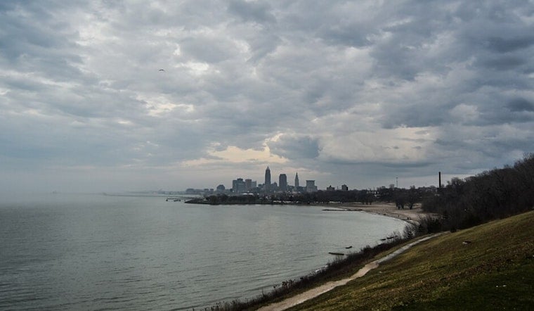
Cleveland rolls into Sunday, April 26, 2026, under a gray lid of low clouds, patchy fog and a chilly start near 46°F. The murk is set to linger through much of the morning, which could drag out that lakeshore drive, before skies gradually clear and afternoon highs climb into the low 60s. A northeasterly breeze around 8 to 10 mph keeps lakefront neighborhoods a bit cooler than spots farther inland.
Fog Lingers, Sun Returns Late
Low stratus is being stubborn and will likely hang onto the lakeshore into early to mid afternoon, with pockets of reduced visibility possible through roughly noon to about 3 p.m. That window is a slight tweak from yesterday's outlook; see our earlier weekend forecast for the setup that led into today.
Storms Possible Late Monday Night Into Tuesday
Late Monday night into Tuesday, April 28, showers and thunderstorms are on the table as a cold front slides through, with forecasters calling for about a 70% chance of rain and southeast winds that could gust into the 30s. Rainfall totals are expected to stay on the lighter side, generally a tenth to a quarter of an inch, but brief heavy downpours and gusty winds are possible. Mariners should keep a close watch, since a Small Craft Advisory may be needed. According to the National Weather Service Cleveland, it is a good idea to check updated forecasts before heading out Monday night.
Lakefront And Commute Notes
If you are pointing the car toward the lakefront this morning, build in extra time and expect patchy visibility. Use low beams in fog, give yourself more following distance and ease off the gas when you hit thicker patches. For outdoor plans Monday night, keep an indoor backup ready and check radar and local forecasts in the hours leading up to your event.
Looking Ahead
High pressure noses back in on Monday with a warmer feel inland, and highs should reach the mid 70s away from the lake, while the shoreline stays cooler. The cold front then ushers in a noticeable cooldown by midweek, and a prolonged upper trough keeps temperatures stuck in the 50s by late week. That cooler air could leave low-lying spots vulnerable to frost toward the weekend, so gardeners will want to cover tender plants.


.jpg)