The National Weather Service in Washington, D.C. is painting a mostly gray picture with overcast skies and a side of isolated showers for the capital region. With a muggy 69°F to start the day, the city is navigating a 20% chance of precipitation and a gentle east wind blowing at 5 mph. As September wanes, residents of D.C. can expect a continuation of mostly cloudy conditions and similar temperatures heading into the evening, with a low circling around 63°F.
As we move into the new week, the forecast remains mostly unchanged, with cloud cover dominating and daily highs around 74°F. While tomorrow may offer a brief respite from the rain, a 40% chance of showers is expected by tomorrow night, according to the National Weather Service. The likelihood of precipitation continues to increase through Tuesday and Wednesday, potentially leading to showers and thunderstorms by Tuesday night.
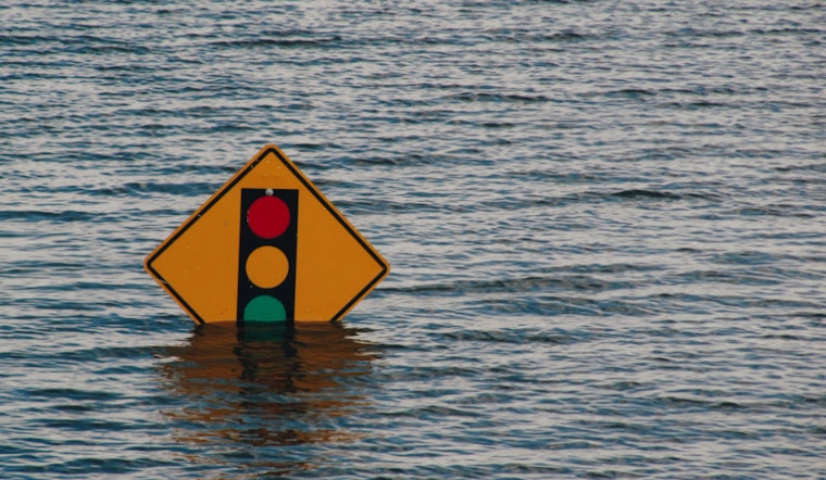
In addition to the ongoing stretch of cloudy days, Washington D.C., and parts of Northern Virginia, including Arlington and Alexandria, face the risk of coastal flooding. A Coastal Flood Warning remains in effect through early Tuesday morning, with one to two feet of inundation above ground level in low-lying areas due to tidal flooding, as noted in the warning.
Spotter activation isn’t anticipated at this time; however, residents are advised to remain vigilant about moderate coastal flooding during high tides early this week, particularly in flood-prone areas like Southwest Waterfront at the DC Seafood Market and near King Street and Union Street in Alexandria. Take necessary actions to protect flood-prone property. If travel is required, do not drive around barricades or through water of unknown depth, cautions the National Weather Service in their latest update. As for the capital's ongoing stretch of cloudy weather, residents can look toward the weekend for potential relief: the forecast suggests some sunshine by Saturday.


