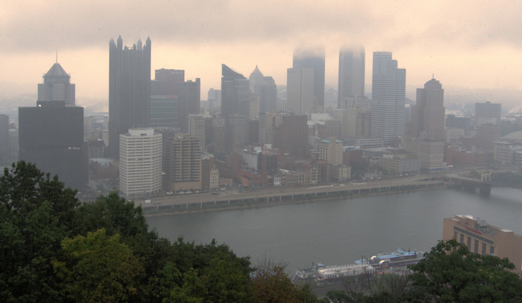
Pittsburgh residents can expect the same soggy weather to cap off September with lingering rain and cloudy skies. Pittsburgh's National Weather Service (NWS) forecasts near to slightly above-average temperatures, thanks to an upper-level low drifting northeastward from Kentucky to the Atlantic coast.
"Mostly light rain continues tonight and into the day tomorrow, primarily south of Pittsburgh," says the latest from NWS. With the upper low set slowly moving east on Monday, the chances for precipitation appear to shift along with it gradually. A cold front is expected to rally by Wednesday, promising to clear up the skies and bring temperatures back to seasonal norms.
The bulk of the rain is predicted to hit southeast of Pittsburgh on Tuesday as the weakening upper low trudges northeast. The Tuesday/Tuesday night period will be a transition period, NWS notes. While not wholly vanishing, the fallout seems less intense, with a cold front pushing showers mainly to the north of Pittsburgh.
Looking towards mid-week, the weather outlook becomes slightly more optimistic. "A cold front passage is expected by early Wednesday, bringing an end to rain chances," according to NWS's report. As we head into the following weekend, Pittsburghers might begin to see a less cloudy and comparatively drier pattern. While a weak front might stir up a few isolated showers around Friday night, the trend hints at a drier spell.
Aviation-wise, the persistent low pressure and remnants of Hurricane Helene have been causing problems. NWS warns of abundant moisture and northward advection of light rain bands, which could result in the development/persistence of MVFR/IFR cigs with only minor vsby restrictions throughout the day. A change in the air mass post-frontal passage on Wednesday afternoon should bring about dry weather and VFR conditions set to last through the end of the week.


