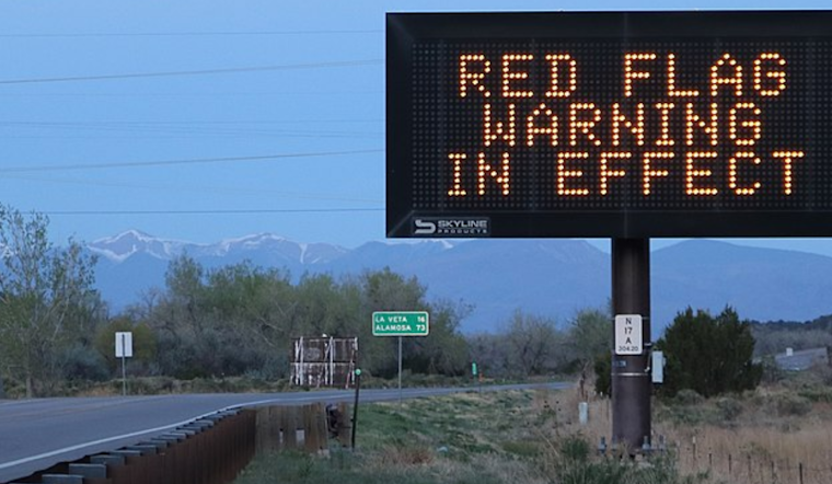
Residents across Denver and the eastern plains are on high alert as the National Weather Service (NWS) has issued a Red Flag Warning effective from noon to 8 p.m. MDT today, advising of critical fire weather conditions. The NWS cautions that coupling of strong winds with low humidity levels and warm temperatures could precipitate extreme fire behavior. According to the warning, winds from the south are expected to reach speeds of 15 to 25 mph, with gusts potentially as high as 40 mph, while relative humidity could drop as low as 12 percent.
According to the National Weather Service, outdoor burning and activities that could produce a spark and start a wildfire should be avoided. The red flag warning has been deemed necessary due to the anticipated wind and low relative humidity affecting Denver, the Palmer Divide, and the eastern plains, encompassed by Fire Weather Zones 240 through 251. The hazardous conditions are likely to persist only for the duration of today into this evening, posing a threat to these areas which have been specified in the cautionary message.
Denver's current weather situation, marked by a few clouds and 62°F, comes with a humidity level lingering around 45 percent and a south wind traveling at 12 mph. This brief respite from the wind is set to give way to a breezy day, with forecasted gusts up to 24 mph and a high near 92, as per the National Weather Service. The forecast also indicates a change with areas of smoke developing tonight, likely attributable to regional fires, and mostly clear skies with a low of around 55 degrees. A southwest wind shifting to a lighter, variable direction past midnight is expected.
Looking ahead, the NWS outlook through next Wednesday suggests a persistence of warm and mainly dry conditions, except for some isolated storms. It was pointed out that temperatures in the mountains are anticipated to drop below freezing on Friday and Saturday mornings, though a slight moderation is expected over the weekend. By Monday night and Tuesday, an upper-level shortwave is predicted to bring a better chance of precipitation to the area, particularly across the Northern Mountains and parts of the plains.


