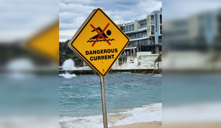
Residents and visitors in the Jacksonville area, along with those across the coastal regions of Southeast Georgia and Northeast Florida, should exercise caution at the beaches this weekend, as the National Weather Service has extended a high rip current risk warning through Sunday evening. The alert affects a number of coastal counties, including Nassau, Duval, St. Johns, and Flagler in Florida, as well as Glynn and Camden in Georgia. NWS Jacksonville advises that "Dangerous rip currents" are expected, posing serious threats to even the strongest swimmers by potentially pulling them away from shore into deeper waters.
As per the last update, the forecast for today in Jacksonville includes cloudy skies with a chance of showers and thunderstorms after 1 pm and light winds becoming northeast at 5 to 10 mph. Gusts might reach as high as 16 mph with a 30 percent chance of precipitation. For those considering braving the beach despite this unsettled forecast, it's critical to stay aware of the high risk for rip currents and the advice to "Swim near a lifeguard. If caught in a rip current, relax and float. Don`t swim against the current." The full forecast and warnings are available on the NWS website.
Moving into the night, the NWS forecasts a continued chance of showers and thunderstorms with cloudy conditions prevailing and a low of around 73 degrees Fahrenheit. The chance of precipitation climbs slightly to 40%. Similar unsettled conditions with higher chances of showers and thunderstorms are expected to persist into Sunday, with the possibility of new rainfall amounting to between a quarter and half an inch.
The extended forecast for the coming week suggests a mix of cloud-covered and partly sunny days, with daytime highs hovering near the low 80s and evening lows dipping into the low 70s. Wind conditions are expected to remain breezy to windy, particularly from Tuesday onwards, when the chance of showers and thunderstorms remains consistent. The NWS reminds beachgoers "If unable to escape, face the shore and call or wave for help."


