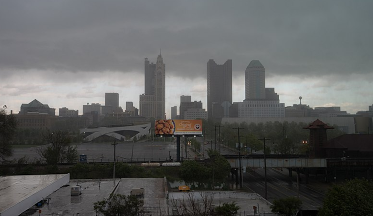
Residents in Columbus, Cincinnati, and the encompassing Ohio Valley are bracing for a wet weekend. According to the National Weather Service, a pattern of slightly warmer air is moving into the region, a trend that's expected to continue through the first half of the coming week, accompanied by several episodes of widespread rain. For those banking on a December chill, seasonably cold air is predicted to return at the week's end.
As of early Saturday, December 14, National Weather Service forecasters have projected "widespread rain tonight into Sunday," with total rainfall amounts by Sunday afternoon tallying up to three-quarters of an inch in some local areas. While the day starts dry, the rain is set to lay siege, beginning from around 6 PM this evening. For central Ohio residents mainly, there is a "low probability scenario" for brief, patchy freezing rain around 06z. However, "widespread icing on untreated surfaces is not expected," as air temperatures should be slightly milder.
A robust moisture transport system involving a 40-50kt H8 LLJ is kicking off the rainy period, creating an expanding shield of rain dousing the area through the latter hours of Saturday into Sunday. The heavier, steady rains should transition to more scattered showers as the weekend approaches, lending credence to the statement that "conditions should trend /'drier' from W to E toward the end of the short term period." According to the National Weather Service forecast.
Looking ahead to next week, Ohio Valley residents aren't quite clear. A "more potent system" will arrive by Monday morning, bringing moisture levels roughly 300% above normal. Forecasters highlight that "we`ll be expecting some efficient rain rates," suggesting the potential for higher than forecasted precipitation. This spells a damp outlook for commuters and the potential elevation of isolated flooding concerns, particularly in areas subject to repeated heavy rainfall.
This series of weather disturbances is projected to culminate in a "good signal for a return to below normal temperatures by the end of the working week," as the National Weather Service states. Despite the complexities tied to mid-to-late-week weather modeling, the takeaway for inhabitants of Columbus, Cincinnati, and adjacent vicinities is clear: umbrellas and rain boots will be paramount, and one should stay tuned for updates on the evolving conditions.
For those seeking to keep abreast of aviation developments, National Weather Service advisories suggest "MVFR to IFR conditions are likely Saturday night into early Tuesday," which is critical information for travelers and regional operators.


