The Jacksonville area braces for uncommon winter weather, as the National Weather Service in Jacksonville issued multiple advisories including a Freeze Warning, a Cold Weather Advisory, and a Winter Storm Warning effective from this evening onwards. With forecasts predicting sub-freezing temperatures as low as 30°F, residents are advised to take precautions against dangerous conditions that could lead to hypothermia or frostbite.
Specific areas affected, according to the National Weather Service, include Coastal Duval, Coastal St. Johns, Eastern Clay, and other nearby regions. "The cold wind chills as low as 25 degrees could result in hypothermia or frostbite if precautions are not taken," the alert stated. Local citizens should wear appropriate clothing, including a hat and gloves, and are encouraged to take measures to protect young children, the elderly, and the homeless during this time.
In addition to the chilling temperatures, the area faces a High Rip Current Risk through late tomorrow night. Dangerous rip currents are expected to affect Southeast Georgia Beaches, posing significant risks to even experienced swimmers. Officials urge the public to swim near lifeguards and follow safety protocols if caught in a rip current.
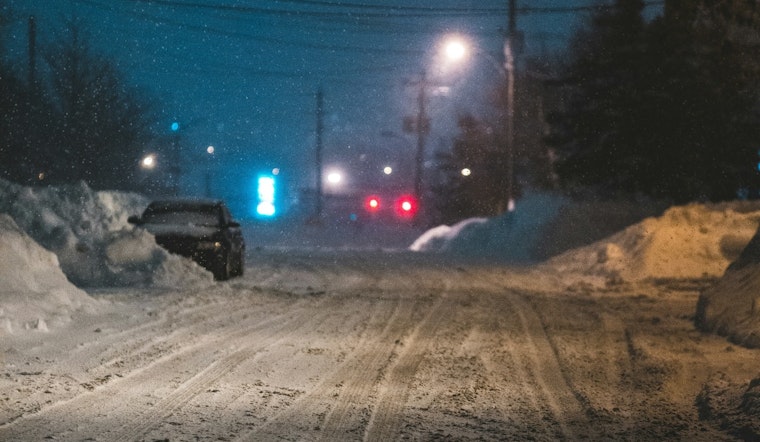
The Winter Storm Warning is a particularly startling development for Jacksonville, given its geographical location and typically mild winters. With the anticipation of heavy mixed precipitation and up to a half inch of snow and sleet accumulation, along with potential ice, transportation may be impacted. "Plan on slippery road conditions. The hazardous conditions could impact the Wednesday morning commute," warns the National Weather Service in their statement on the imminent winter storm.


