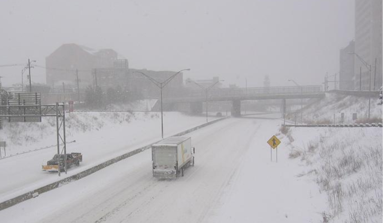
The National Weather Service has issued an urgent weather update indicating that parts of Ohio, Kentucky, and Indiana are bracing for a significant winter event today through Monday. According to the NWS forecast, residents in these areas should expect heavy snowfall, sleet, and freezing rain, with storm accumulations potentially reaching up to a foot in specific locales.
In preparation for the winter storm, regional warnings have been implemented. Specifically, a Winter Storm Warning has been issued for parts of Ohio from 10 AM today to midnight EST Monday night. At the same time, a Winter Weather Advisory starts this afternoon and extends to the same period for other Ohio zones. Entangled in this severe weather web, cities like Columbus and Cincinnati are projected to see snowfall rates of an inch per hour for several hours, further amplified by low visibility and vicious winds picking up late tonight as the pressure gradient tightens.
On the heels of the storm, bitter cold is expected to grip the area. "Daytime highs only in the mid to upper 20s and lows tonight in the low to mid 20s" are predicted, with even harsher wind chills down into the single digits, according to the NWS. Monday will see additional snow accumulations as any mixed precipitation transitions back into the snow, making for perilous travel conditions and potential power outages from weighed-down tree branches and ice accumulation.
Looking beyond the immediate storm, the forecast discussion from the National Weather Service outlines a chilly week ahead. As colder air continues to dominate, temperatures will plummet, bringing overnight lows into the single digits by Wednesday and Thursday nights, while wind chills could drop to sub-zero levels. The little reprieve in sight as possible light snowfall mid-week may add to the frozen environment. However, accumulations are expected to be minimal and mainly confined to specific areas.
For those needing to travel, the forecast is a source of caution. The aviation outlook is grim, with IFR conditions extending into Monday afternoon and potential lingering MVFR ceilings into Wednesday. Anyone navigating the skies over the Columbus and Cincinnati regions should be prepared for significant disruptions.


