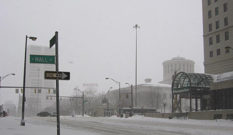
An arctic air mass has settled firmly over the Ohio Valley, holding sway with a frosty grip that promises to tighten before the weekend's respite. According to the National Weather Service (NWS), the current forecasts suggest that Columbus, Cincinnati, and surrounding areas are in for a continued cold snap, keeping in line with temperatures that have stubbornly refused to climb above the lower to middle 20s.
Adding to the winter tableau, "a southern tracking low pressure system will bring additional snow accumulation to the region Friday into Saturday," as the National Weather Service described. Despite the daytime highs remaining well below normal, the area may see a break in the frigid pattern with temperatures slightly rising through the weekend — but not before another surge of colder air plunges the region into a deep freeze next week.
This evening, the situation might seem rather bleak, particularly near the Tristate area where, expecting to clear out the lower stratus clouds, locations could see air temperatures near or below zero degrees. "Given that more locations may observe air temperatures near or below zero degrees, even a light surface wind could result in `feels like` temperatures between -5 to -10 degrees at times," the NWS warns. Such conditions may necessitate a Cold Weather Advisory, especially for residents in southern counties.
As we look ahead to Thursday through Tuesday, the long-term outlook remains unkind with the approach of an upper-level trough out of the Mississippi Valley, which could spell widespread snow by Friday evening. The NWS predicts snow accumulations generally in the 1 to 3-inch range. Highs on Friday are expected in the mid to upper 20s, with another pulse of arctic air forecasted to follow close on the heels of the weekend, dropping high temperatures further to the upper teens to mid-20s by Tuesday.
For locals and travelers alike, aviation may be affected with "MVFR to IFR ceilings and visibilities possible Friday night into Saturday," according to the National Weather Service, suggesting potential delays or disruptions at regional airports, including KCMH/KLCK, which are closely monitoring for periods of light snow that could become possible by this afternoon. This spells caution for those planning to travel by air during this period, as indicated by the recent aviation outlook.
The NWS advisory underscores the need to stay informed about rapidly changing weather conditions. It remains essential for residents of Ohio Valley to prepare, stay warm, and perhaps hunker down as Ohio's winter shows no signs of easing up anytime soon. Keep an eye on the sky and another on the thermometer. It's shaping up to be a bracing season.


