The National Weather Service (NWS) in Jacksonville, Florida has issued a Cold Weather Advisory alongside a Rip Current Statement warning residents and visitors of the harsh conditions expected. The Cold Weather Advisory, in effect from 1 AM to 10 AM EST Friday, forecasts very cold wind chills hitting as low as 23 degrees. Specific areas impacted include Coastal Duval, Eastern Clay, Eastern Putnam, South Central Duval, and Eastern Marion Counties.
A key danger highlighted is that such low wind chills could bring about hypothermia or frostbite if precautions are not taken. NWS advises the public to "Wear appropriate clothing, a hat, and gloves," to avoid such risks. Words like 'danger' and 'precautions' underscore the severity of the advisory, while still sticking to the facts without excessive embellishment or sensationalism.
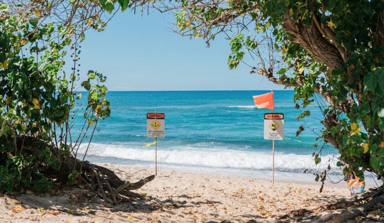
Concurrently, Northeast Florida beaches are now facing a "High Rip Current Risk" through late tonight, as per the statement on the NWS website. This alert warns of dangerous rip currents and rough surf, with breakers ranging from 4 to 6 feet — conditions that are not to be underestimated. Coastal Nassau, Coastal Duval, Coastal St. Johns, and Coastal Flagler will be particularly affected.
The potential impact on swimmers is serious, with rip currents known for their power to sweep even the strongest of swimmers out to deeper waters. To prioritize safety, the NWS advises swimmers to "Swim near a lifeguard" and provides guidance on what to do if caught in a rip current: "Relax and float. Don't swim against the current. If able, swim in a direction following the shoreline. If unable to escape, face the shore and call or wave for help," the advisory states.
Looking ahead, Jacksonville's weather is forecast to improve gradually with temperatures rising, indicating sunny days with highs nearing the mid-70s by next Tuesday. However, a 40 percent chance of showers predicted for the following Thursday suggests a brief return of wetter weather.


