The National Weather Service in Raleigh, North Carolina, has alerted residents to a mix of weather conditions likely to affect the area starting today and into the coming week. After a misty morning, skies should clear up, giving way to a mostly sunny day with a high nearing 68 degrees, as reported by the NWS Raleigh. A calm northeast breeze is also on the docket at around 6 mph.
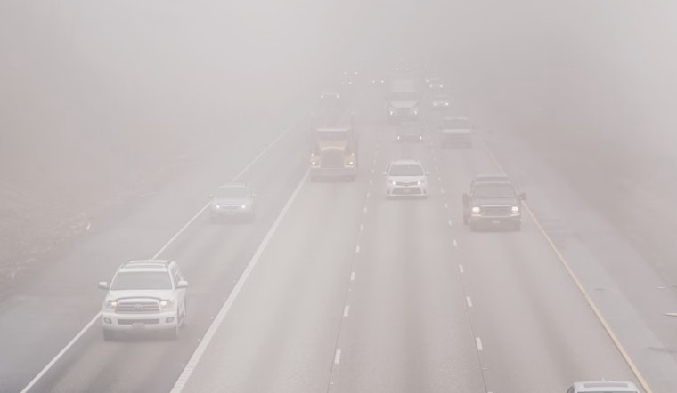
As the evening rolls in, the forecast anticipates increasing clouds with a low settling around 51 degrees, and an easy east wind trailing in at 3 to 5 mph. The weekend, however, looks more unsettled — a Saturday sprinkled with patchy drizzle and fog, expected to lift by 11 am, will make way for mostly cloudy skies and a high approximately 79 degrees, along with gusty winds as strong as 22 mph, according to the NWS Raleigh.
Approaching Sunday, the weather gears up for more drastic changes. The NWS predicts "showers likely, then showers and possibly a thunderstorm after 2pm," with brisk winds around 20 to 22 mph, and gusts potentially reaching 38 mph. With a high near 75 degrees on Sunday, there's also concern for "localized flash flooding, particularly in urban areas," as noted in their Hazardous Weather Outlook.
The Hazardous Weather Outlook extends into the week with mostly sunny conditions on Monday, highs in the mid-60s to mid-70s, and clearer nights until Thursday, where there's a 30% chance of showers. All while the looming potential for storms and high winds particularly on Sunday, the report emphasizes the possibility of "thunderstorms with strong to locally damaging wind gusts and brief tornadoes," and the role wind will play, growing "increasingly windy Saturday night through Sunday, with occasional gusts of 35 to 45 mph possible," likely to keep spotters alert and ready.
Citizens are advised to stay aware of the changing conditions and to prepare accordingly, especially as the NWS cautions that "spotter activation may be needed on Sunday." With safety as a priority, residents in central North Carolina should stay updated on the latest forecasts and heed any instructions from local authorities during this period of volatile weather.


