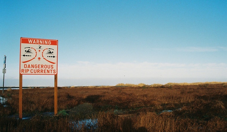
The National Weather Service in Jacksonville, FL has issued a High Rip Current Risk notice effective through late tonight for parts of Southeast Georgia and Northeast Florida beaches. According to the NWS' announcement, dangerous rip currents are expected and beachgoers are strongly advised to swim near lifeguards and follow safety instructions to avoid becoming caught in these potentially deadly currents.
Moreover, drivers in the area should exercise caution this morning due to patchy dense fog, which is reducing visibility to a quarter mile or less in some spots. Patchy dense fog will reduce visibilities to one quarter mile or less at times this morning, the National Weather Service stated. The fog's patchy nature means that visibility may change frequently during travel. As part of the precautionary measures, swimmers who find themselves in a rip current should relax, float and not swim against the current, aiming to follow the shoreline if possible. If unable escape, they should face the shore and signal for help.
Aside from the rip current risk, the weather forecast for Jacksonville looks mostly sunny with high temperatures approaching the upper 80s in the coming days. For today, after the fog lifts, residents can expect a high near 87 degrees with southeast winds ranging from 5 to 13 mph, and gusts as high as 20 mph. Tonight's weather will remain partly cloudy with a low around 69 degrees and breezy conditions as mentioned in the detailed forecast provided by the National Weather Service.
As for the extended outlook, the temperatures in Jacksonville will continue to soar, with highs predicted at or around 89 degrees through the weekend, dipping slightly early next week to a high near 83 amid showers and a possible thunderstorm on Monday. By Tuesday, there's a 40 percent chance of showers with a mostly sunny high expected near 72. The city is in for a mix of warmth and gusty winds but should prepare for wetter conditions at the start of next week.


