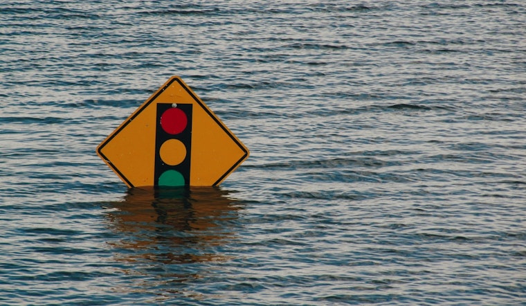
The National Weather Service in Raleigh has issued a flood watch for a swath of central North Carolina due to the potential for excessive rainfall, in effect from 1 PM EDT this afternoon through this evening. The region, including counties such as Alamance, Chatham, Davidson, and Wake, should brace for possible flooding caused by heavy rains. Residents are advised to monitor forecasts and be prepared to take action should flooding develop. The watch is a caution against the expected excessive runoff that may lead to the uprising of creeks and streams, potentially spilling over into urban and low-lying areas, as reported by the NWS.
In the detailed forecast, there is a 60% chance of showers and thunderstorms likely mainly after 4pm today, with new rainfall amounts between a tenth and quarter of an inch possible, however, that number can climb due to local thunderstorms, "including the Triad, Triangle, Rocky Mount, Goldsboro, and Roanoke Rapids," as warned by the NWS Flood Watch; the same areas are still reeling from recent saturated soils due to previous days' rainfall. These conditions could lead to localized flash flooding in the regions, particularly in regions north and east of US-64, where communities face a higher risk of flood-related impacts.
Additionally, the NWS cautions about the possibility of severe thunderstorms Sunday afternoon and evening, mainly along and north of US-64, with a few strong to locally damaging wind gusts not out of the question. Concerns extend into the upcoming days with a marginal to slight risk of flash flooding on Sunday and Monday, mainly during the afternoons and evenings, and higher risks present in the northern territories of NC. In the swath of summer's embrace, heat indices creeping to 100-105 degrees on Wednesday and Thursday heighten concerns for those more vulnerable to heat complications.
Spotter activation might be necessary, highlighting the role of community vigilance in the midst of these potentially hazardous conditions, "Spotter activation may be needed," advises the Hazardous Weather Outlook by the NWS for those days with elevated risks, underscoring the importance of preparedness and community reporting in light of the unfolding weather scenario.


