Raleigh residents can expect a series of gloomy days with a consistent chance of rain, according to the latest updates from the National Weather Service in Raleigh, NC. Starting today, the forecast suggests a 30% chance of precipitation with less than a tenth of an inch expected to fall. As the week progresses, this pattern of potential showers and thunderstorms is set to continue, with temperatures peaking at a comfortable high in the upper 70s and lower 80s, as per the NWS forecast.
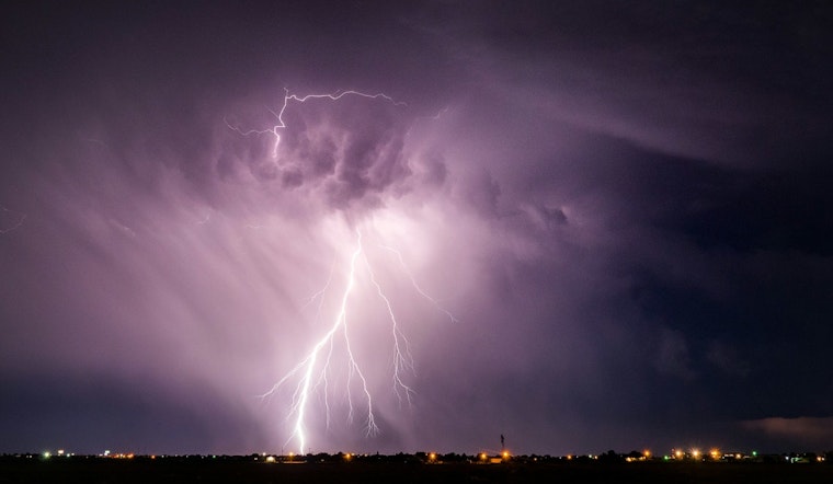
Tonight, locals should not to be surprised to see raindrops post 2 a.m., as the forecast indicates a 40% chance of rainfall. Despite the overcast conditions and the unyielding Northeast wind set to persist through the evening, the rain isn't expected to be substantial, with new precipitation amounts of less than a tenth of an inch possible. Look for more of the same Wednesday, with chances of showers and thunderstorms after 2pm adding a frisson of unpredictability to your mid-week routine.
The NWS forecast for Raleigh throughout the rest of the week doesn't fare much better when it comes to wet weather. Thursday will bring a 50% chance of showers and thunderstorms in the afternoon, a pattern that's looking to repeat on Friday with similar probabilities for rainfall. If you're planning outdoor activities, keep an umbrella close at hand and an eye on the sky.
Into the weekend, the weather is not much looking up, with rain chances hovering around 40-50% from Saturday through to Monday. You might want to hold off on that lawn picnic until after the weekend, as both showers and thunderstorms are possible each day. The National Weather Service advises to stay tuned for potential updates as this week may include unexpected instances of flash flooding.
While "hazardous weather is not expected at this time," as stated in the Hazardous Weather Outlook by the NWS. Wednesday carries a Marginal, level 1 of 4, the risk for excessive rain - meaning flash flooding could become an issue. Weather enthusiasts and concerned citizens are encouraged to report significant conditions, keeping the community informed and prepared.


