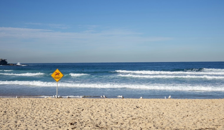
The National Weather Service in Jacksonville, Florida, has extended a Coastal Flood Advisory for several counties until 8 PM tomorrow, warning residents and visitors of minor coastal flooding and high rip current risks. The advisory affects Coastal Duval, Coastal Flagler, Northeast Coastal St. Johns, and Southeast Coastal St. Johns Counties, according to the NWS report. These conditions are a result of persistent northeastern winds that are not only pushing waters onshore but also creating dangerous marine conditions.
The Coastal Flood Advisory by the NWS have cautioned the public to prepare for the possibility of "flooding of lots, parks, and roads with only isolated road closures expected." Moreover, they have advised against swimming due to "dangerous rip currents" that can pull even experienced swimmers away from the shore into deeper waters. In situations where travel is required, extra time should be allotted as some roads may be closed and it is recommended that drivers do not drive around barricades or through water of unknown depth.
The NWS detailed forecast points to a series of sunny or mostly sunny days ahead this week for the Jacksonville area, with highs comfortably settling in the mid-80s. Evenings are expected to be mostly clear with temperatures dropping to the mid to high 60s. However, by the time weekend approaches, there's a forecasted 30 percent chance of showers and thunderstorms on Saturday, turning into a 50 percent chance by Sunday. Residents looking to enjoy the pleasant sunny days should nonetheless stay vigilant of the coastal and marine hazards.
Precautionary measures and preparedness actions have been advised, including directives to swim near lifeguard stations and to never swim against a rip current. Instead, individuals caught in a rip current should "relax and float," and if able, swim parallel the shoreline. Those unable to escape the current should face the shore to call or wave for help, as per the Rip Current Statement by the NWS.


