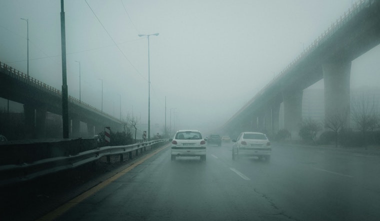
The National Weather Service in Greenville-Spartanburg area issued a special weather statement today about dense fog conditions affecting parts of North Carolina and South Carolina, advising caution for morning travelers. Specifically, visibility has been reduced to 1/2 mile or less, and this includes journey along important corridors like I-40 from Marion to Mocksville and along I-85. A warning was included for drivers in the region to slow down and use low beam headlights when encountering the fog. The advisory expects the fog to lift by late morning.
For Charlotte, N.C., the conditions are a bit milder but still notable with the current temperature standing at 37°F and a high humidity level of 93%, leading to an atmosphere shrouded in fog and mist, which could affect travelers and locals venturing out early in the day. The local forecast, as detailed by the National Weather Service, points towards areas of fog before 10 a.m., after which it is expected to become cloudy with the high near 48. Tonight paints a similar picture with patchy fog appearing after 11 p.m. and the mercury dipping to a low around 32.
Moving on to the remainder of the week, Charlotte residents and those nearby can expect a dance of clouds and sun, with denser fog on Sunday morning, but partly sunny skies afterward, and a daytime high approaching 50 degrees. Coming into Sunday night, there’s a 30 percent chance of rain, mainly after 4 a.m., while Monday will see chances of rain before the afternoon. Temperatures will fluctuate moderately with Monday night clearing up and the low chilling down to around 24.
Looking forward, local weather patterns should bring about brighter skies by Tuesday, with sunny conditions and a high nudging 44 degrees. This relatively stable mix of sunny and mostly sunny days will extend through much of the upcoming week. Highs will rise progressively, reaching towards the mid-50s by Wednesday and remaining thereabouts through Thursday. However, on Thursday night, residents should brace for a possibility of rain, with the likelihood at about 30 percent and lows hovering in the upper 30s.
In summary, while the dense fog might pose a travel nuisance during morning hours, it shouldn't overstay its welcome, as more favorable conditions are forecasted to emerge as the hours pass. Commuters should nevertheless heed the advice to proceed with additional caution during these times of reduced visibility.


