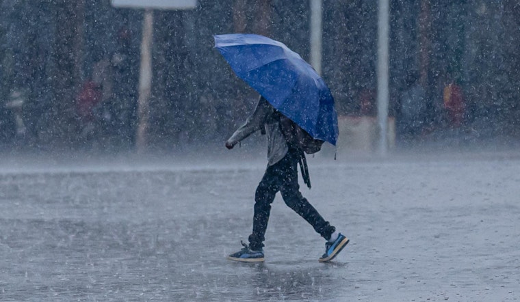
Seattle wakes up under thick clouds and low 40s, about 43°F, this morning on Saturday, February 21, 2026, with rain already in the picture and a brief mix of snow possible before the main band moves through. Steadier rain will develop across the lowlands later today, with heavier, more widespread precipitation arriving Sunday into Monday. At the same time, gusty easterly winds will strengthen this afternoon, and coastal waters will turn rough.
Afternoon Winds Pick Up
East-southeast breezes will ramp up this afternoon and turn gusty across the Cascade foothills, Whidbey Island and parts of central Puget Sound, with gusts up to 40 to 45 mph possible through the evening. A Wind Advisory is in effect for the foothills and nearby valleys into Sunday morning, so now is the time to secure loose outdoor items before the worst gusts arrive. These wind details and local headlines come from NWS Seattle.
Rain And Snow Through Monday
Rain and snow are likely Saturday, with a high near 47°F and temperatures dipping into the upper 30s overnight. Snow will mainly stick to higher elevations as snow levels rise from roughly 2,000 to 2,500 feet this morning to around 3,500 to 4,000 feet by Sunday. The wettest stretch comes Sunday into Monday, and lowland totals of a quarter to a half inch are expected Sunday with a half to three-quarters of an inch possible on Monday. For background on the multi-day soaking and what it means for river levels, see our earlier coverage on how the short dry spell is doomed.
Boaters And The Marine Forecast
Coastal waters and the Strait of Juan de Fuca will see building seas and gale-force gusts, with wave heights possibly rising toward 20 to 25 feet late tonight, so mariners should expect rough and dangerous conditions. Small craft advisories and gale warnings are posted for portions of the coastal and inland waters, and boaters should check the latest marine products before leaving port. Those watches and advisories are posted by NWS Seattle.
Plan For Your Weekend
Bring waterproof layers and give yourself extra travel time from Saturday night through Monday, as slick bridges and reduced visibility are likely during heavier bursts of rain. If you are headed into the Cascades, check mountain-pass conditions before you go, and keep an eye on river forecasts if you live along tributaries such as the Skokomish, which forecasters say could rise later next week.


