Milwaukee rolled into Friday, March 6, 2026, with drivers squinting through a thick layer of fog and light drizzle, temperatures hovering near 39°F, and visibility at Mitchell Airport chopped down to roughly three-quarters of a mile. In some low-lying and lakeshore neighborhoods, the fog has been even more stubborn, dropping visibility to a quarter mile and turning the morning commute into a slow, slick crawl for anyone on the roads or sidewalks.
Morning Fog And The Commute
The National Weather Service has a Dense Fog Advisory up through 9 a.m. Friday, March 6, 2026, warning that visibility may fall to one-quarter mile or less across parts of southeast Wisconsin. The message is simple: slow down, keep headlights on, and leave more room than usual to stop. Commuters should plan for delays on surface streets, ramps, and along the lakefront, and expect bus and rideshare trips to take longer than normal. For the latest watches and warnings, see NWS Milwaukee.
Storms And Rain This Afternoon And Night
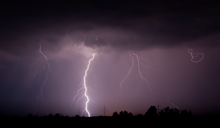
Once the fog begins to ease, the next act arrives from the southwest. Showers and scattered thunderstorms are expected to spread into the area between mid-morning and early afternoon, pushing daytime highs toward 58°F with precipitation all but guaranteed. Forecasters are calling for roughly 0.5 to 1.25 inches of rain in many spots, with locally higher totals possible. Embedded thunderstorms could deliver brief, heavy downpours and damaging wind gusts.
The most intense storms are favored late Friday evening into the overnight hours, when gusts could reach 30 mph and isolated hail may pop up. With the ground still partly frozen, any heavy bursts of rain could quickly lead to standing water on low-lying roads and in poor drainage areas. For earlier coverage and additional context, see Milwaukee vanishes in morning fog.
Weekend Outlook
A cold front is expected to clear eastern Wisconsin Saturday morning, dragging in a cooler air mass and kicking up breezy west winds of 15 to 20 mph with gusts up to 30 mph. Afternoon highs should slide into the mid-40s. Sunday looks like the pick of the weekend, with drier, sunnier weather and highs near the upper 50s, before another system brings a chance of rain Tuesday into Tuesday night. Check the full forecast and any new warnings at NWS Milwaukee.
Bottom line: leave extra time for travel this morning, try to stay off the roads during any heavy downpours, and if you have to drive, slow down, turn on your headlights instead of high beams, and pad your following distance. Keep a weather app handy and stay tuned for updated advisories through the afternoon and evening.


.jpg)