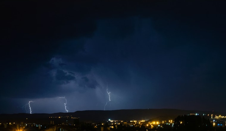
While most of the North Carolina Piedmont was still asleep early Monday, the National Weather Service was tracking a fast-moving line of thunderstorms that packed small hail, frequent lightning and gusty winds strong enough to snap tree limbs and toss around anything left outside. Doppler radar lit up with a compact but intense cluster racing across parts of the region in the predawn hours, and local emergency officials urged residents to shelter in place until the warnings expired.
According to The Charlotte Observer, the alert remained in effect until 4:15 a.m. and specifically included Rocky Mount, Roanoke Rapids, Nashville, Louisburg, Warrenton, Norlina, Dortches, Littleton, Bunn and Red Oak. NWS Raleigh reported storms producing hail up to about 0.5 inches in diameter and wind gusts reaching 40 mph, with forecasters warning that the gusts could knock down tree limbs and blow around unsecured outdoor items. The warning area covered Vance, Warren, Halifax, Franklin and Nash counties.
Radar Tracked A Fast-Moving Cluster
The Charlotte Observer noted that NWS Raleigh said, “At 3:18 a.m., Doppler radar tracked a cluster of strong thunderstorms 10 miles northwest of Nashville, moving northeast at 60 mph.” That kind of speed put the core of the storms on a quick sprint across the Piedmont before sunrise, giving residents little time to react once the storms arrived.
Lightning Risk And Safety
The NWS warned that the frequent lightning made these storms especially hazardous, since lightning strikes the United States about 25 million times each year. Most strikes occur in summer, yet about 20 people die annually from lightning, according to the agency. Forecasters recommend heading into a substantial shelter as soon as you hear thunder and waiting 30 minutes after the last lightning or thunder before going back outside. For more guidance, see the National Weather Service safety tips.
Broader Outlook And How To Follow Updates
The early morning thunderstorms across the Carolinas were part of a broader system that forecasters said could generate damaging winds and hail across portions of the Eastern United States, according to The Associated Press. Officials advised residents to keep phones charged, stay tuned to local radio and television for new warnings and avoid travel while storms are actively moving through.
People in the path of storms were also encouraged to move vehicles under cover if possible, secure outdoor furniture and check on neighbors who might need assistance. Local emergency managers and the NWS planned to continue issuing updates on changing conditions through the morning.


