Sacramento is rolling into the weekend under mostly cloudy skies and about 55°F at Sacramento Executive Airport as of Friday morning, April 10, and Mother Nature is not easing into things. Rounds of showers and thunderstorms are marching through the Sacramento Valley into the weekend, with the heaviest rain expected Friday into Saturday and snow levels dropping in the Sierra. Gusty southerly winds and isolated strong storms, including small hail or brief funnel clouds, could complicate both commutes and mountain travel.
Today And Friday
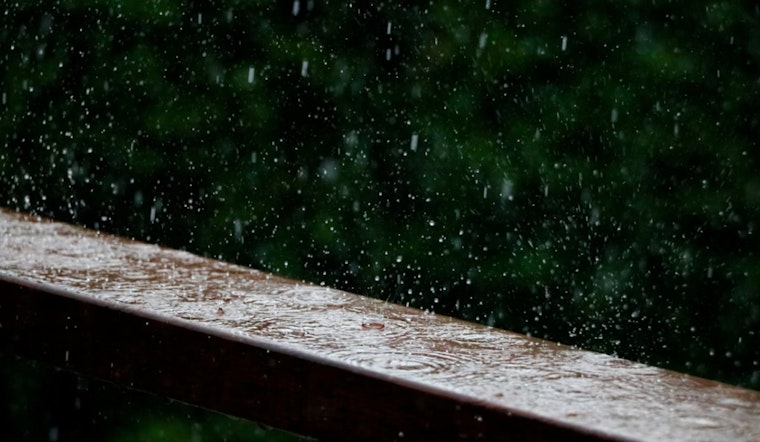
Friday, April 10, is shaping up to be a wet one, with numerous showers and a good chance of thunderstorms. The high will reach near 67°F, and forecasters put precipitation odds at about 80 percent. Heavier downpours could quickly drop a quarter to a half inch of rain in some spots, which means slick roads and reduced visibility during the afternoon commute.
South-southwest winds are expected to run from a few miles per hour up to around 8 mph, but stronger thunderstorm cores may kick out brief, erratic gusts and lightning, according to NWS Sacramento.
Weekend Outlook
The system ramps up on Saturday, April 11, with rain likely before late morning, followed by showers and thunderstorms that can linger through the day. By Saturday night, some neighborhoods could pick up roughly three-quarters of an inch to an inch of rain.
South winds will increase Saturday, with gusts climbing into the 20s mph in exposed Valley corridors. The strongest cells may deliver hail or brief funnel clouds. The setup follows the late-week pattern Hoodline noted earlier in the week.
Mountain Travel And Road Alerts
A Winter Storm Warning is in effect for parts of the northern Sierra from 5 p.m. Friday through 11 p.m. Sunday. Snow levels are expected to fall over the weekend, and heavy snowfall rates from Saturday into Sunday could make mountain roads hazardous.
Officials warn that the heaviest snow and strongest winds will be above roughly 4,500 feet, and drivers could encounter chain controls or even temporary closures on passes such as I-80 and Highway 50. Before heading into the mountains, travelers are urged to check the latest NWS briefing and road conditions on Caltrans QuickMap.
How To Prepare
Plan on giving yourself extra time for errands and slow down on wet roads, since standing water and brief street flooding are possible during heavier bursts of rain. Move outdoor plans inside if storms threaten, keep phones charged, and avoid driving through any flooded stretches. As forecasters like to say, when thunder roars, go indoors.
If a mountain trip cannot be postponed, carry tire chains, warm layers and an emergency kit, or wait until conditions improve.


