Nearly 63 percent of the United States is now in drought, and this spring the Mid‑Atlantic has quietly joined the country’s trouble spots. Maryland and Washington, D.C., are sitting in some of the hardest‑hit territory, with rivers, reservoirs and soils running low after a dry winter and an unusually warm March. Local water managers are already eyeing the coming runoff season and the prospect of restrictions if meaningful rain does not show up soon.
National Snapshot
Federal tracking lays out the numbers in stark terms: as of April 29, 2026, Drought.gov reports that 51.54% of the U.S. (including Puerto Rico) and 61.68% of the Lower 48 are in drought (D1–D4), affecting roughly 155 million people. The U.S. Drought Monitor map, updated weekly, is the benchmark many agencies use to gauge impacts, declare burn bans and weigh water restrictions. Those percentages are unusually high for spring and reflect broad precipitation shortfalls across the Plains, the Intermountain West and parts of the Southeast.
Where Drought Is Hitting Hardest
Nationwide reporting points to several standout hot spots: nine states and Washington, D.C., are shown as entirely in drought, while Florida and Arkansas are more than 99% covered, according to The Washington Post. "The West’s hydrology and climate are very much out of sync with the historical rhythm," Assistant Utah State Climatologist Jon Meyer told The Post, a line officials have leaned on to explain why mountain snowmelt and reservoir recharge have lagged this year.
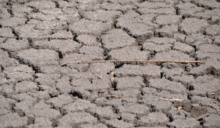
Maryland Conditions
Closer to home, state measurements confirm the stress building in local waterways. The Maryland Department of the Environment’s hydrologic summary flagged below‑normal streamflow and groundwater in several regions and placed much of the state at a "Watch" level in its late‑February update. Lower flows on rivers such as the Patuxent and Monocacy, along with depressed groundwater readings in central counties, are exactly the signals water managers track before moving from voluntary conservation to mandatory cutbacks, according to the Maryland Department of the Environment.
Why Snowpack Matters and the Outlook
One big red flag sits far from the Mid‑Atlantic: mountain snowpack. Colorado State’s climate center warned this spring that "the mountain snowpack is in historically bad shape," which means weaker spring and summer runoff for many Western and interior water systems. The National Oceanic and Atmospheric Administration’s Climate Prediction Center is also projecting drought to persist into summer across the Intermountain West and the Plains in its seasonal outlook through July, limiting the odds of a quick turnaround. Low snowpack combined with a stubborn dry forecast raises the risk that parched regions will stay that way into peak water‑use months, complicating life for reservoirs, farms and the cities that depend on them; see the Colorado Climate Center and NOAA for more detail.
What Residents Should Know
For people in Maryland, D.C. and other hard‑hit areas, the near‑term playbook is familiar: conserve water where you can, hold off on nonessential outdoor watering and pay attention to local guidance as the season unfolds. Local utilities and state agencies post updates and, when needed, restrictions. Residents can track conditions and find current recommendations through Drought.gov and their state or city water agency. If May and June rains fall short, officials say targeted limits are more likely than sweeping shutdowns, but much will depend on how much runoff and precipitation actually arrive in the next several weeks.


