

























































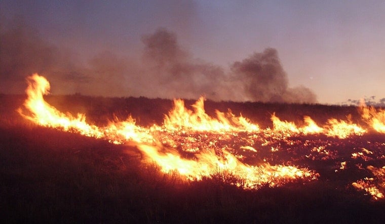
A fast-moving brush fire along Kolob Terrace Road, now officially dubbed the Mesa Fire, had residents near Zion National Park on alert Wednesday night as evacuation warnings rolled out and crews scrambled to keep the flames away from homes and cabins.
How Big Is The Fire And Who Is Responding
The Mesa Fire was mapped at about 6 acres in the Kolob Terrace Road area and was threatening several structures, according to KJZZ. Hurricane Valley Fire and Rescue crews stayed on scene alongside state resources as firefighters worked to hold the line and keep the blaze from growing.
Officials moved several nearby neighborhoods into "Set" status, meaning residents should be packed up and ready to leave on short notice while crews monitored containment and weather conditions.
Evacuations, Mapping And Power Warnings
Washington County emergency management directed residents to the Genasys Protect evacuation map, which flagged a "potential threat to life and/or property" in affected zones and urged anyone who needs extra time to evacuate, or who has pets and livestock, to leave early, according to Genasys Protect.
By late Wednesday night, Zion National Park had been removed from the evacuation area, although one nearby zone remained under a "Set" warning as fire activity was reassessed, KSL reported. County officials also cautioned that public-safety power shutoffs could be used in the Virgin area while firefighters work the incident, a move that could knock out electricity in order to reduce additional fire risk.
Park Context And Fire Risk
Zion National Park put Stage 2 fire restrictions in place on May 22, 2026, limiting most campfires and other activities that can throw sparks, according to the National Park Service. Those rules are meant to head off exactly the kind of fast-moving brush fires that can erupt along the Kolob Terrace and Kolob Canyons corridors on hot, windy days.
The terrain there has seen its share of trouble in recent years. The park’s 2022 Kolob Upper Fire showed how quickly flames can run through that landscape under the right conditions, the National Park Service has reported.
Where To Get Updates
Officials are urging residents to keep a close eye on the Washington County Genasys Protect map for any changes in evacuation status or zone designations. The tool provides real-time labels such as "Ready," "Set" and "Go," along with preparedness tips for each level.
For local response details and contact information, residents can check the Hurricane Valley Fire District website. Area news outlets are also tracking conditions as they change. This story will be updated as agencies release new information.





