Monuments, national parks, and scenic waterfronts make Washington, D.C. an ideal destination for runners—just make sure to go out early or late on those hot and humid summer days.
Using data from fitness app Strava and other trail route sources, we found the most popular, interesting, and challenging routes within the district's limits.
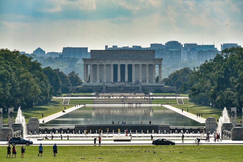
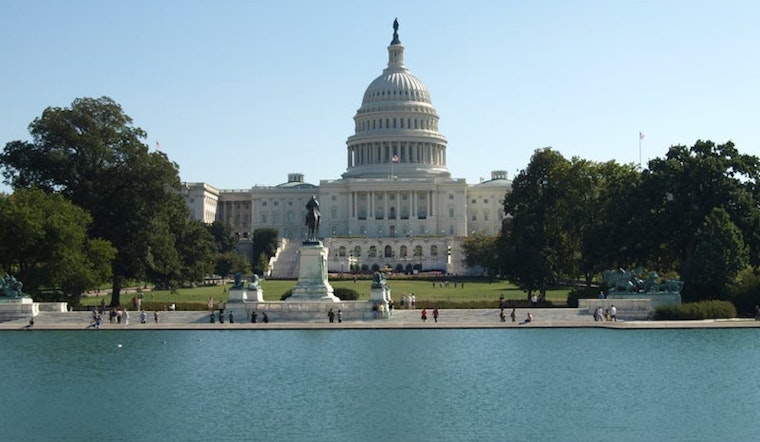
National Mall
Capitol Hill/National Mall/the Monuments
The size and number of buildings, trails and open spaces in the central part of the city make it perfect for inspiring, car-free runs. The loop between the Lincoln Memorial to the west and the Capitol building to the east is 4.5 miles. Runners looking for an urban extension of the route will continue another 1 mile east to Lincoln Park. Given the many events and protests happening in the area, check for clear routes before heading out.
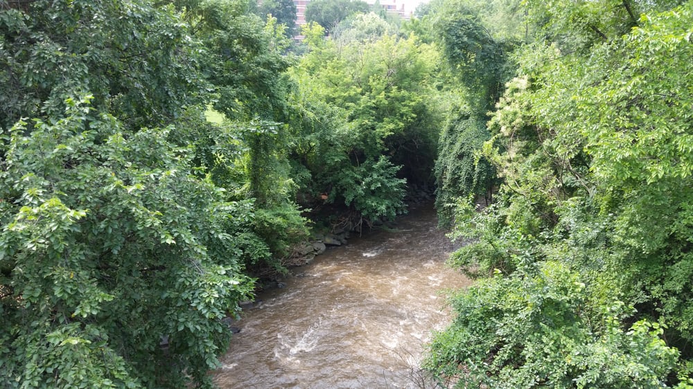
Rock Creek Trail (South)
Foggy Bottom/West End/Adams Morgan/Georgetown
If you take the Rock Creek Trail from the Lincoln Memorial up the river a mile or so, you'll find the mouth of the creek. Follow the trail up the creek another four miles to Prce Mill for a surprisingly natural-feeling landscape that ends in Rock Creek National Park. Water has carved a deep ravine and connected gullies along the waterway, creating a series of microclimates for plants and animals—and cool shade for runners. Depending on where you start and turn around, the route will be 9.0-10.0 miles roundtrip. The trail can get crowded but is due for expansion soon.
More details on Rock Creek Runner and Strava>>
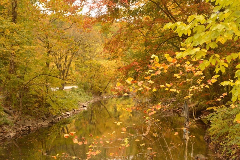
Rock Creek Park
Mount Pleasant/Crestwood/Chevy Chase
From Pierce Mill, Rock Creek Park—one of the first national parks in the country—stretches north around 4.5 miles to the Maryland border. You'll have a range of routes to choose from including Beach Drive (closed to cars on weekends), the Western Ridge trail and the Valley Trail, which all range around 5 miles one way and involve elevation changes of a few hundred feet through the forested natural setting.
More details on Rock Creek Runner, Alltrails.com, MapMyRun and Strava>>
Capitol Crescent Trail
Georgetown/Palisades
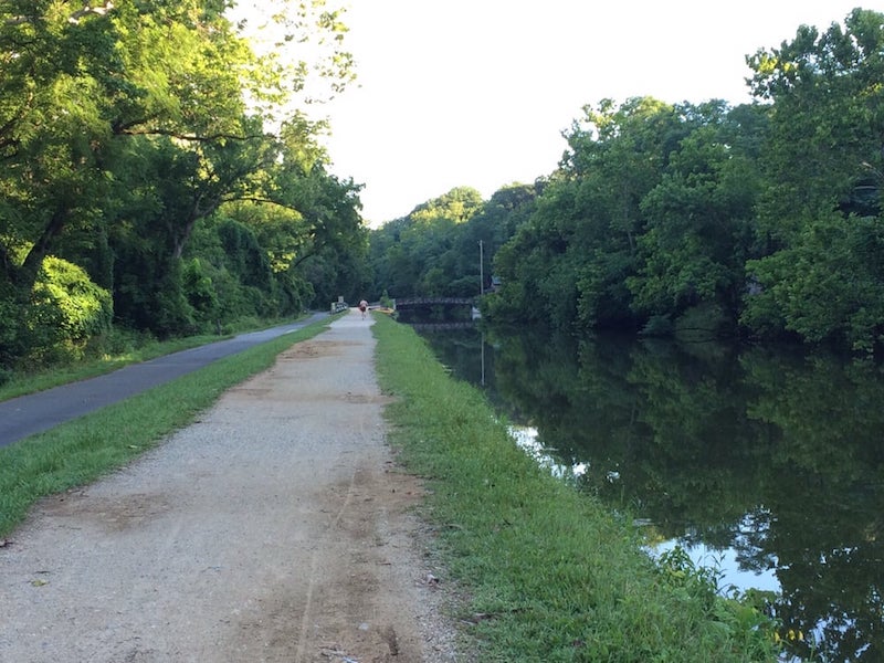
Branching off to the west at the mouth of Rock Creek, this 11-mile route to Bethesda, Maryland is a former rail line that has been converted to its present use starting in the 1980s. The paved mixed-use trail follows the Potomac for the DC portion before turning inland at the state border. Enjoy the shade, but watch for crowds on nice days. If you want to get closer to the river, try the C & O canal trail for the same stretch.
More details on the Coalition for the Capital Crescent Trail and AllTrails.com >>
Anacostia Riverfront Trail
Anacostia
This new and growing trail system on the southeast side of the district is providing more recreational opportunities to a part of the city that has been long neglected. While parts of the trail are so new that we don't have much data on them, the main 12-mile loop around the Anacostia River has already been getting considerable local use. An additional 4-mile section was added in 2016, creating a connection with more than 40 miles of trail to the north and east in Maryland.
Read more on the official site and Greater Greater Washington >>


