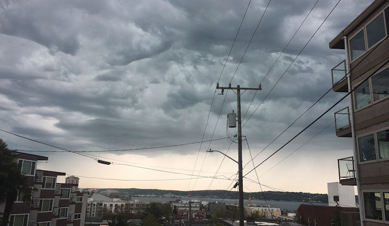
Seattle braces for showers and possible thunderstorms today as cloudy skies promise a damp start to the week. According to the National Weather Service's Seattle office, with a 60 percent chance of precipitation, residents should be ready for intermittent rain before 2 PM followed by likely showers and a potential thunderstorm between 2 PM and 3 PM; the chance of rain and thunder continues post 3 PM.
Temperatures are expected to peak at a mild 54 degrees amidst a gentle south wind, stirring at around 9 mph. Seattleites might encounter less than a tenth of an inch of new rainfall throughout the day but could see higher amounts in thunderstorms. Following the update early this morning at precisely 04:05 AM PDT, the skies over Seattle hung heavy with an overcast gloom, marking temperatures at a cool 46 degrees Fahrenheit with humidity clinging at 75%. In comparison, winds from the south-southwest nudged the mercury to a 42-degree wind chill.
Looking ahead, the forecast signals lighter precipitation chances tonight from showers and thunderstorms before 8 PM, then dipping between 8 PM and 10 PM. At the same time, the clouds persist, and temperatures drop subtly to around 42 degrees after sundown. The work week starts with a persistent 50 percent likelihood of rain on Monday, potentially escalating to a gusty 90 percent chance of precipitation by the night.
Mid-week forecasts anticipate steady showers early Tuesday before yielding to partly sunny conditions on Wednesday, though the chance for rain reasserts itself towards the end of the week. Residents should expect a high of 58 degrees under partly sunny skies during the day while the nights will see the mercury fall to 44 degrees and an eventual increase in clouds creeping back into the city's weather narrative Thursday carries a possibility of showers again increasing as nighttime nears with the likelihood of rain climbing high into Friday.


