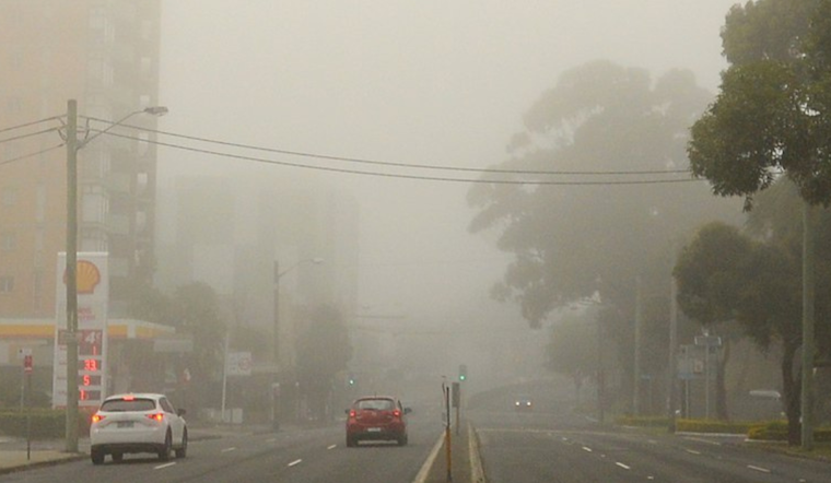
As the city of Nashville wakes up, a shroud of fog envelopes the skyline, prompting the National Weather Service (NWS) Nashville to issue a Dense Fog Advisory lasting until 8 AM CDT today. Visibility is expected to be between one-quarter to one-half mile in dense fog, affecting a significant portion of Middle Tennessee, including Nashville and surrounding cities. Commuters should anticipate slower-than-usual traffic and are advised to exercise caution.
Looking past the morning's fog, a sunny day is decidedly clear up with high temperatures peaking near 83 degrees. The light winds shifting from west to northwest should help to dissipate the morning mist. The serene weather is set to continue throughout the week, with clear skies and nighttime lows hovering around the mid-50s. As the week progresses, temperatures are expected to climb, with highs reaching into the mid-90s, potentially setting the stage for a hot and sunny weekend.
Nashville residents planning their week should take note of the consistently sunny days ahead, with the only variation being the gradual temperature rise. According to the National Weather Service, "Calm wind becoming north around 5 mph in the afternoon," suggests a gentle shift in wind patterns, unlikely to disrupt daily activities. With clear nights also in the forecast, the city should see an uninterrupted stretch of typical early summer weather.
Given the current weather trajectory, next week's temperatures appear set to further increase, with Nashville heading into a particularly warm period. Kicking off with a high of 80 on Tuesday, by Sunday, we're expected to hit a sweltering 97 degrees. The heat rise will doubtless influence outdoor plans, and locals are reminded to stay hydrated and take frequent breaks if engaging in extended outdoor activities.
-1.webp?w=160&h=400&fit=crop&crop=edges)


Kingsford_fog-1.jpg)