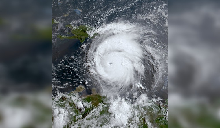
As Hurricane Beryl made its third and final landfall, residents in the Houston area braced themselves for the impact of what was once a Category 4 hurricane. Beryl, which weakened to a Category 1 before hitting near Matagorda, brought with it dangerous storm surge and fierce winds, according to early morning reports from the Houston Chronicle. The hurricane's path was set to cut through many communities, ultimately aiming towards the Longview region in East Texas.
Tropical Cyclone Beryl, which the National Weather Service's Storm Prediction Center had on watch, was forecast to significantly disrupt the region with a mix of hazards. Tornadoes were deemed possible throughout the day in areas extending from East Texas into Northwest Louisiana and Southwest Arkansas, with the storm's northeast quadrant wrapping itself into an unstable atmosphere. To further amplify the situation, the forecast indicated that the storm's trajectory could lead to tornado production, particularly during peak instability periods stretching from the mid-afternoon into late evening.
Houston's Office of Emergency Management (OEM) emphasized the importance of early preparation and released a set of guidelines for residents. Actions encouraged included stocking up on 5-7 days worth of food and water, medications, and considering the needs of vulnerable family members and pets. Officials urged residents to solidify a family communication plan and reminded them about utility shut-off procedures, as stated in a public notice.
Amidst the chaos, credible sources became vital for disseminating accurate updates and safety information. The City of Houston Emergency Information Center, National Weather Service Houston/Galveston Forecast Office, and various recognized local networks were listed as the go-to channels for current developments regarding Beryl's trajectory and residual effects, including flooding and storm damage trajectories.


