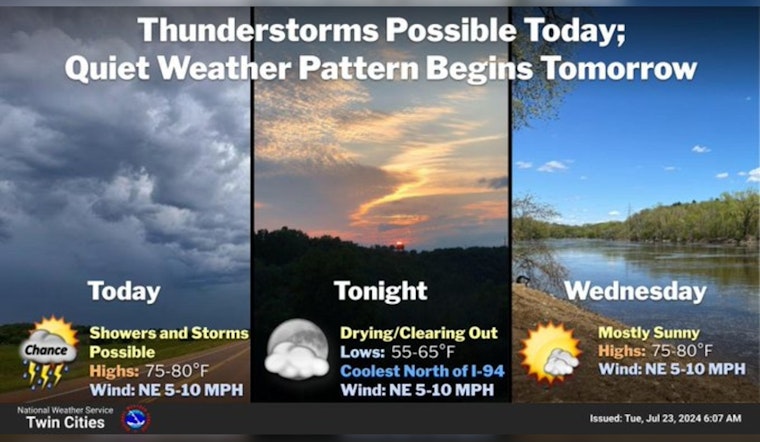
Minneapolis residents can expect a mix of weather conditions over the next week. Today, there's a 30 percent chance of rain and thunderstorms, mainly between 10 a.m. and 5 p.m., with a high near 78 degrees, according to the National Weather Service. Moving into the evening, the chance of precipitation drops to a mere 10 percent before 7 p.m.
Showers and thunderstorms across central MN will gradually weaken this morning. Storm redevelopment is expected mainly south and west of the I-94 corridor this afternoon. A few storms could contain gusty winds, heavy down pours, and small hail. #mnwx #wiwx pic.twitter.com/oldkOa996l
— NWS Twin Cities (@NWSTwinCities) July 23, 2024
The weather outlook for Minneapolis predicts patchy morning fog followed, by mostly sunny skies and steady temperatures in the upper 70s to high 80s. Nighttime lows will stay in the 60s for the most part, bumping up to around 70 degrees by the weekend. Winds will generally remain light, with some south winds reaching 10 to 15 mph, with gusts as high as 25 mph by Saturday.
For those concerned about the potential for severe weather, the Hazardous Weather Outlook released early this morning indicates that no severe weather is expected, although "a few storms may produce heavy rain or small hail." Commuters should be aware that areas of fog early this morning may reduce visibility significantly.


