Minneapolis residents are advised to stay vigilant concerning the potential for hazardous weather conditions. Today's forecast a 30 percent chance of showers and thunderstorms late in the day, with a similar pattern expected this evening, as reported by the National Weather Service. The week ahead is also poised to bring more rainfall, raising the stakes for areas already grappling with river flooding.
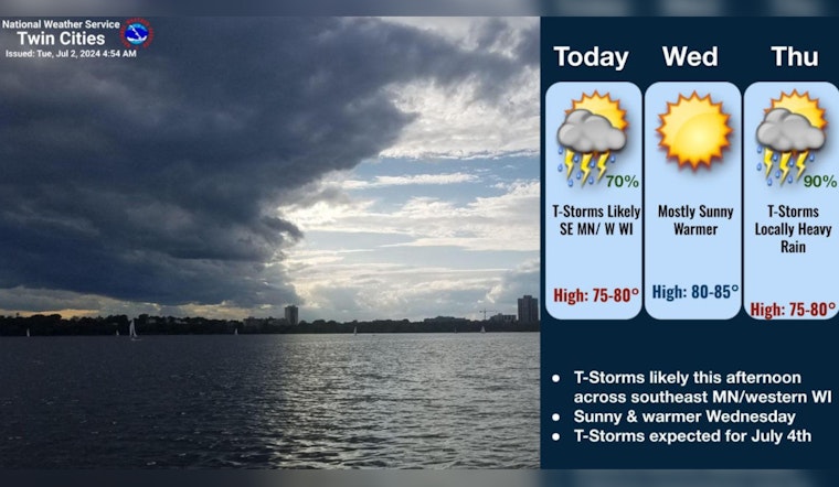
Rain will end early this morning with thunderstorms redeveloping this afternoon across southeast MN 🙴 western WI. Scattered rain showers are possible elsewhere across MN.
— NWS Twin Cities (@NWSTwinCities) July 2, 2024
After a sunny Wednesday, plan on a wet 🙴 stormy July 4th with locally heavy rain possible.#mnwx #wiwx pic.twitter.com/C0Ljlc41Ox
According to the National Weather Service, thunderstorms are anticipated this Independence Day, creating a scenario where heavy rainfall may exacerbate existing flood conditions. The river flooding along the Minnesota and Mississippi Rivers is already at moderate or major flood stage, and while recent rains are not expected to trigger a new rise to past crest heights, they may prolong the duration of the flooding.
As per the NWS Hazardous Weather Outlook, the most significant threat for severe weather will be near the Iowa border, where heavy rain and isolated strong storms could occur. Yet, it also reassured the public that SKYWARN spotter activation would not be needed.
Moving into the latter part of the week, the forecast suggests a 70 percent chance of showers and thunderstorms on both Thursday and Friday, as detailed by the National Weather Service. The service warns of the potential for heavy rainfall, with amounts estimated to reach between 1 and 2 inches.
The consistent pattern of storms has prompted officials to extend flood warnings for several rivers. For example, the South Fork Crow River at Delano, currently experiencing minor flooding, is expected to recede by tomorrow evening with flood-stage impacts involving the necessity of storm sewers potentially requiring plugging to prevent backflow into city streets, shared by the NWS Hazardous Weather Outlook.
The situation at the Crow River in Rockford and the Minnesota River at Savage remains critical, with the latter under major flood-stage conditions. The Mississippi River at St. Paul is also affected, impacting Dakota, Washington, and Ramsey Counties. Residents near these areas are advised to avoid flooded roads and follow all safety precautions, including heeding road closures and not driving through flooded areas.


