The National Weather Service in Morristown has issued a forecast that Knoxville residents should heed with caution over the next several days. As we wake this morning to fog and mist with a near-saturated air marking a humidity at a full 100%, a volatile weather pattern is set to unfold. According to the National Weather Service's latest reports, we should anticipate "showers and thunderstorms likely, mainly after 5pm" today, with "some of the storms could produce heavy rainfall." The high today is expected near 89 degrees, with heat index values climbing as high as 96, and a light southwest wind projected to increase from 5 to 10 mph in the morning.
The relative calm of the current conditions is likely to quickly change as the day progresses. The chance of precipitation stands at a significant 70%, and the National Weather Service warns that new rainfall amounts between a quarter and half of an inch are possible. As we move into the evening hours, "Showers and thunderstorms likely, mainly before midnight," with chances continuing post-midnight and a low temperature hovering around 71 degrees. Winds are predicted to remain consistent, blowing from the southwest at around 5 mph.
Looking ahead to the weekend, Saturday's forecast calls for a continuation of the stormy pattern with a 50 percent chance of showers and thunderstorms, mainly after 2 pm. The day is set to be partly sunny and hot, with highs nearing the 90-degree mark while heat index values could reach a sweltering 98. The likelihood of precipitation and thunderstorms persists into Saturday night, with an "80%" chance, as detailed by the National Weather Service.
For those planning outdoor activities on Sunday, it would be wise to prepare for potential weather interruptions. There will be showers likely and possibly a thunderstorm before 8 am, with chances for more showers and thunderstorms continuing throughout the day. Temperatures are again set to soar to highs near 84, accompanied by southwest winds of 5 to 10 mph. In the evening, the pattern is set to continue, with a 60% chance of precipitation expected.
Looking into early next week, Monday will offer a slight reprieve with a 40 percent chance of showers and thunderstorms mainly in the afternoon, and more sunshine with a high near 81 degrees. As we venture into Tuesday and Wednesday, the skies will clear, giving way to sunny days and a slight drop in nighttime temperatures to the low 60s.
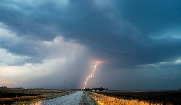
In addition to the forewarned weather conditions, the National Weather Service has also put forth a hazardous weather outlook alerting to the possibility of strong to severe thunderstorms and localized flooding. "A few of
these storms may become strong to severe with damaging winds the primary threat," the outlook states, underlining the potential severity of the situation. Spotter information reports of "thunderstorm damage or flooding Friday and Saturday will be appreciated." It's a critical reminder for residents to remain vigilant and responsive to weather alerts and to report any hazards to assist the community.


