Minneapolis residents should prepare for a range of weather conditions today, following the National Weather Service's recent forecast. Predictions for today include showers and thunderstorms primarily before noon, with a 70% chance of precipitation and potential rainfall between a tenth and a quarter of an inch, though thunderstorms might lead to higher amounts. It's advised to be on the lookout for patchy fog before 8 a.m., while the rest of the day is expected to be mostly cloudy with highs nearing 79 degrees and north-northwest winds around 5 mph, per the National Weather Service.
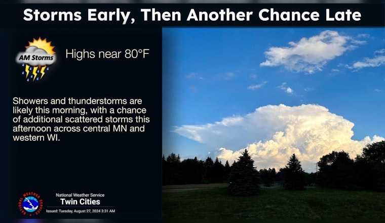
Showers and thunderstorms are likely this morning, with a chance of additional scattered storms this afternoon across central MN and western WI. Severe weather is not expected this morning, but a couple stronger storms are possible this afternoon. pic.twitter.com/ENEyL6hMVf
— NWS Twin Cities (@NWSTwinCities) August 27, 2024
The likelihood of showers and thunderstorms dissipates this evening to a mere 10 percent before 7 p.m., giving way to patchy fog after midnight. Despite a mostly cloudy evening, temperatures will descend to a low of around 63 degrees, accompanied by a north-northeast wind at around 5 mph, as reported by the National Weather Service. Looking ahead to Wednesday, areas of fog are possible before 9 a.m. However, the clouds should clear up, leaving behind a mostly sunny day with a high near 78 degrees and an east-northeast wind at 5 mph.
As Thursday rolls in, Minneapolis can anticipate a higher chance of precipitation, with the National Weather Service forecasting "a chance of showers and thunderstorms, then showers and possibly a thunderstorm after 1pm." Residents should be prepared for an 80% chance of rain, with new rainfall amounts expected to be between a half and three-quarters of an inch. The day's high should hover around 80 degrees with a south-southeast breeze around 10 mph.
Thunderstorm chances continue into Thursday night, with a 50 percent likelihood of events occurring before 1 a.m. Despite the potential showers, conditions will trend towards mostly clear skies with a low of around 60 degrees and a southwest wind blowing at 5 to 10 mph. As for the approaching weekend, forecasts promise sunny days and clear nights, with temperatures fluctuating between a comfortable high of 80 degrees on Saturday and a cooler high of 72 degrees by Sunday, along with a closed night that doubles as calm winds gradually pick up to around 5 mph, marking an idyllic prelude to the Labor Day holiday.
The Twin Cities region isn't entirely clear of severe weather threats. The National Weather Service issued a Hazardous Weather Outlook early this morning for parts of central and southern Minnesota, including Minneapolis. Severe storms with the potential for strong winds and heavy rainfall are of particular concern this morning. An even broader area, extending into west central Wisconsin, is on alert for additional scattered showers and storms throughout the afternoon. Although no hazardous weather is expected from Wednesday through Monday, the National Weather Service notes that "SKYWARN spotter activation may be needed," indicating the unpredictable nature of severe weather occurrences and the need for community preparedness, according to the weather service.


