Baltimore locals can expect a stretch of sunny, dry days ahead as high pressure takes the weather helm today. The National Weather Service in Baltimore, MD/Washington DC predicts "sunny skies" for the day, with temperatures settling in the low to mid-80s and cooling down into the low to mid-50s by nightfall. If city noise keeps you awake, instead blame the "ideal conditions for radiational cooling" as clear skies and calm winds promote a swift temperature drop, especially in downtown areas where lows could hover in the low 60s.
Those looking to plan activities through until Thursday should comfortably leave their umbrellas behind, relying on the extended presence of high pressure to ward off precipitation. The skies above Maryland will play host to "mostly sunny skies" on Wednesday, as confirmed by the National Weather Service, with light winds shifting from the northwest today to the east and southeast by midweek. Although remnants of Tropical Storm Francine are set to sweep clouds across our corner of the sky, they're expected to keep their distance, and the dry spell remains unbroken.
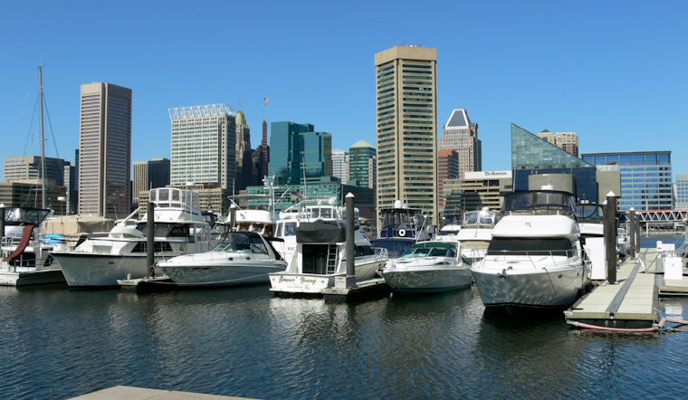
Boaters in the Chesapeake Bay can also look forward to tranquil waters, with the marine forecast anticipating sub-Small Craft Advisory (SCA) level winds stretching into the weekend. This means that despite varying directions over the next few days, winds will largely stay under 10 knots. The forecast from the National Weather Service advises mariners of the possibility of near-SCA conditions by Sunday afternoon, specifically over the middle bay waters, so bear this in mind if your weekend plans include taking to the sea.
Long-term predictions hold onto the dry theme, with "the end of the week looks dry" and the weather system remaining consistent through Monday, as per the National Weather Service forecast. While the offshore high pressure from New Jersey holds strong, Baltimore might see more clouds, but no significant rainfall. For the weekend warriors, it's more good news: high temperatures are expected to remain in the comfortable upper 70s to lower 80s range, supporting all your sun-fed outdoor adventures.
Tide-wise, significant shifts are not on the horizon. Tidal anomalies are expected to hold relatively steady, with a few spots like Annapolis and DC's SW Waterfront possibly reaching the action stage. Still, flooding isn't in the cards this time around. So, if a walk along the waterfront was part of your leisurely plans, it seems the weather gods have granted their blessing for uninterrupted strolls.


