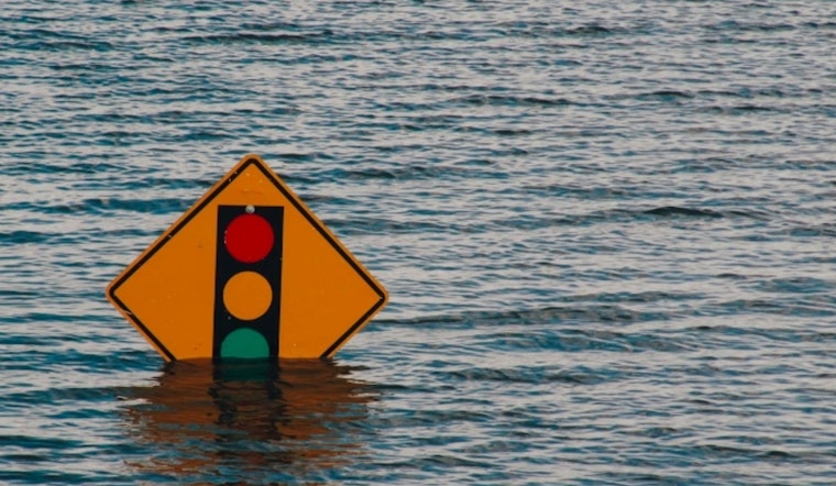
Residents in Washington, D.C. are urged to stay alert as a Coastal Flood Advisory has been extended until 8 AM Sunday, warning of up to half a foot of flooding in low-lying areas due to tides. High tide times at Washington Channel are expected at 5:35 AM and 6:12 PM, according to the National Weather Service.
Low-lying regions along the district's shoreline, including areas next to Ohio Drive and the Hains Point Loop Road, as well as near the Tidal Basin and Jefferson Memorial, stand to be impacted the most. Local authorities encourage residents and visitors to plan ahead, as tidal levels are expected to be one and a half to two feet above normal. Those with travel plans should also be prepared to encounter possible road closures, and the National Weather Service warns against driving around barricades or through waters of unknown depth to help ensure safety.
The weather outlook detailed by the National Weather Service forecast for the next several days in Washington, D.C. suggests a mix of cloudy skies and precipitation. Today, though starting with a slight chance of showers and patchy fog in the early morning, should gradually become sunny with highs approaching the mid-80s. As we transition into the evening, clouds are expected to once again gather, leading to scattered showers and possible thunderstorms come Sunday afternoon.
Looking ahead into early next week, the forecast anticipates that showers are likely to continue, with thunderstorms possible after 2 PM on Monday. East winds will persist, adding a chill to the humid air that envelopes the capital. The actionable point for those who are living in or traveling to the affected areas is to stay updated on the latest weather conditions and heed any advisories issued by local authorities. Taking the necessary steps to safeguard against flooding is recommended as the district prepares for several days of anticipated rainfall.


