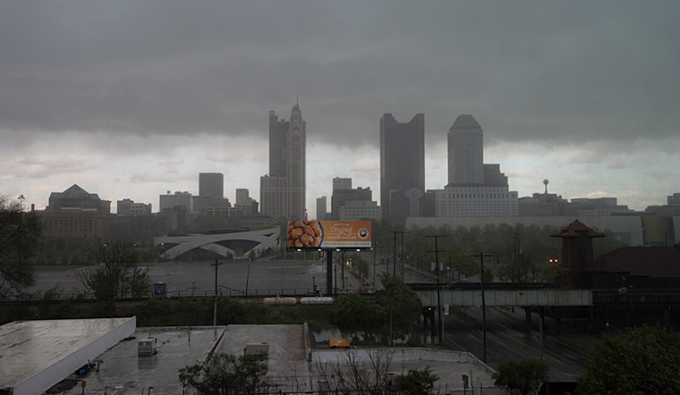
Residents across the Columbus, Cincinnati, and Wilmington areas should keep their umbrellas and raincoats closed as a persistent low-pressure system continues to blanket the region with showers. The National Weather Service confirmed we're in for a dreary end to the week, predicting "unsettled conditions" that will hang around until early next week, with better weather on the horizon come midweek.
Today's forecast paints a wet picture, with a stubborn low-pressure area over western Kentucky. "Energy rotating around this low has brought showers into the southern part of the forecast area already," says the NWS. Those commuting from the south might face another wave of rain, expecting "half to three-quarters of an inch of rain across southern counties," Luckily, no severe weather is expected to amp up local flooding concerns. While trudging through the dreariness, temperatures will remain largely static, a small mercy at a time when preferring a rain check for most outdoor activities seems to be the rational choice.
The next few days don't look much brighter. That low-pressure moseying across Kentucky is taking its time, maintaining the chances of showers with paltry additional rainfall expected. The nights and days will blur with "lows in the lower to mid-60s and highs in the lower 70s," according to the National Weather Weather, setting the stage for a rather monotonous climate over the weekend.
Looking ahead, the start of the week still sees us grappling with this soggy scenario but with an end in sight, advises the NWS. Late Monday into Tuesday, things start to clear with "a strong signal for fog or stratus and fog formation," signaling a moist withdrawal of the rains. Temperatures will descend, slipping into crisper 40s and 50s by Tuesday night. Anticipate a break in the clouds by Wednesday, with sunshine warming things back into the middle 60s and around 70, bringing a glimmer of hope and heralding drier days ahead.
Aviation-wise, travelers can anticipate delays with "gradually spread north" showers pulling down ceiling levels through less-than-ideal MVFR ranges into IFR territory. East winds will get a little indecisive, backing to the northeast, so those flying in or out should prepare for potential revisions to their itineraries well into Tuesday night.


