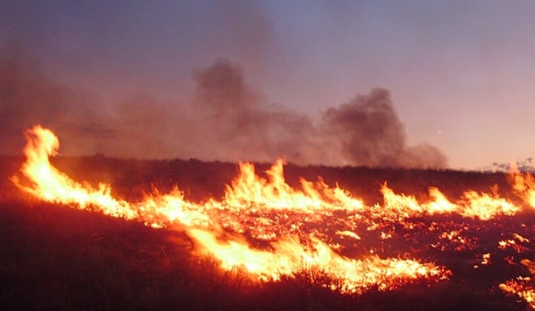
The National Weather Service in Baltimore, MD/Washington, D.C., has issued a special weather statement warning residents of elevated fire danger today due to dry conditions and strong winds. According to the National Weather Service, "Relative humidity values around 30 percent are expected along with sustained north westerly winds of 15 to 20 mph and gusts 25 to 30 mph." This combination may lead to rapid drying of fine fuels, increasing the risk of wildfires in the area.
For those parking vehicles on dry grass, it’s important to heed warnings and keep them off combustible areas. The National Weather Service advises against using open flames or equipment that could create sparks and urges proper disposal of fire sources like cigarette butts and matches in appropriate containers. The announcement stressed the need to obey local burn bans, as conditions could easily ignite and spread fires quickly.
Looking ahead into the weekend, the forecast indicates clear skies with daytime highs ranging from the mid-60s to the upper 70s. However, nighttime temperatures are expected to drop, with lows ranging from the upper 30s to mid-50s. Tonight, the weather will remain clear with a low around 41 and the wind calming down to a north direction at 5 to 7 mph, as per the National Weather Service.
The National Weather Service Hazardous Weather Outlook also reinforces this message, noting that no hazardous weather is expected from Friday through Wednesday, following today's risk period.


