Jacksonville's shores are currently grappling with natural forces as the National Weather Service has reported an ongoing coastal flood advisory and a high rip current risk effective through much of the weekend. The advisory is set to remain active until 6 AM EDT Monday, October 21, with the rip current risk lasting through late tomorrow night.
Beachgoers are cautioned of minor flooding around times of high tide and the increased probability of dangerous rip currents, particularly along Northeast Florida beaches which includes the areas of Coastal Nassau, Coastal Duval, Coastal St. Johns, and Coastal Flagler, but despite these warnings, locals and tourists alike are urged to remain vigilant as these weather conditions are known to be unpredictable and situations may change swiftly.
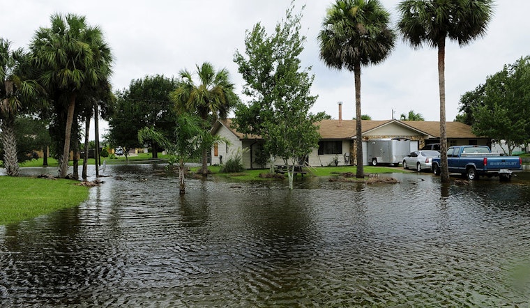
The expected impacts, as detailed by the National Weather Service, include flooding of parking lots, parks, and roadways with potential for isolated road closures. Authorities are advising against driving through floodwaters or around barricades and encourage residents to take measures to secure properties prone to flooding.
As for the rip current risks, the Service advises individuals caught in a rip current to relax and float, not attempt to swim against the current and if possible, to follow the shoreline or signal for help. It's emphasized that swimming near a lifeguard increases safety; these natural phenomena can quickly sweep even the strongest swimmers from shallows into deeper waters.
Residents and visitors in Jacksonville and its surrounding coastal regions should plan accordingly for travel disruptions and heed the warnings issued as the week progresses into more breezy and potentially hazardous weather conditions according to the forecast.


