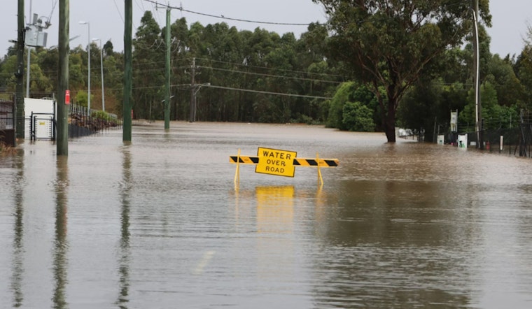
Residents across portions of Knox and Sevier counties in East Tennessee are facing ongoing concerns for safety and property as a dam floodgate release continues to swell the French Broad River, according to a Flood Warning issued by the National Weather Service. The warning emphasizes the imminent risk of flooding in low-lying and flood-prone areas.
The communities along the river have been on high alert since the dam's floodgate release was reported, with local law enforcement and emergency services advising residents to evacuate if threatened. The National Weather Service advises, "If you live in a low-lying area near the river and feel your residence may be threatened, please self-evacuate." They also warn to "Turn around, don`t drown when encountering flooded roads. Most flood deaths occur in vehicles."
The Knoxville area's latest weather forecast doesn't predict additional heavy rainfall, with only scattered showers expected later in the day contributing less than a quarter of an inch to water levels. The forecast straight from the NWS notes, "River flooding continues across northeast portions of Tennessee. While additional heavy rains are not expected, some showers will be possible off and on this afternoon. Additional rainfall amounts will be less than a quarter of an inch in most locations."
Looking ahead, the NWS Hazardous Weather Outlook, spanning the period from Wednesday through Monday, suggests a reprieve may be on the horizon. No hazardous weather is expected in the outline, which should allow to gradually ease the flood situation and begin recovery efforts in the affected areas. In the meantime, residents are urged to stay updated with the latest advisories from the National Weather Service and to heed all instructions from local authorities.


