Minneapolis residents can expect a chilly start to the week, with temperatures dipping to near freezing levels, according to the National Weather Service (NWS). A forecast issued reveals that early risers on Columbus Day may encounter areas of frost before the day gradually warms to a high of around 51 degrees. With the wind blowing from the north northwest at 5 to 10 mph.
Nighttime doesn't offer much respite, as more frost is predicted after 4:00 a.m., alongside partly cloudy skies and lows around 35 degrees. Tuesday will see a repeat of these frosty conditions before 9:00 a.m., only to clear into sunny skies with 54 degrees on the thermometer. Come Tuesday night, the term "widespread frost" enters the forecast, primarily set for after 5:00 a.m., and alongside mostly clear conditions that culminate in a low around 34 degrees.
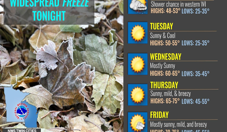
Residents will experience variations throughout the week with Wednesday offering a respite from the chill as temperatures climb to a comfortable 60 degrees. A clear progression into warmer days is foretold – reaching a peak of approximately 74 degrees on Friday. Evenings remain cool, although less severe than the start of the week, with lows around 45 on Wednesday night and climbing to mid-50s by week's end.
A hazardous weather outlook also issued by the NWS warns of "widespread sub-freezing temperatures" early Tuesday morning. The cold snap extends across central and southern Minnesota, engulfing even west-central Wisconsin. These temperatures pose a risk to sensitive vegetation and, perhaps to the unprepared pedestrian venturing out in the pre-dawn hours.
As we head into the weekend, residents should keep an eye out for a changing weather scenario. The forecast presents a 30 percent chance of showers Friday night, increasing to 40 percent on Saturday. While daytime highs remain in the upper 60s, evening temperatures will settle near 50 degrees.


