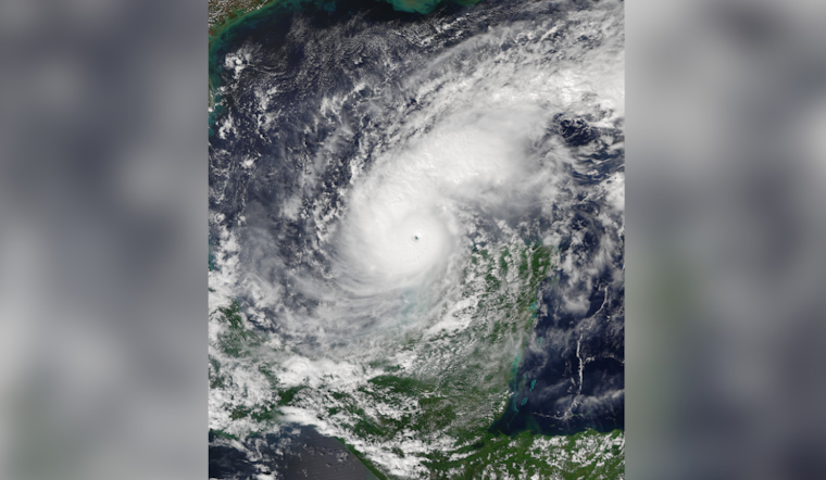
As Hurricane Milton surges toward Central Florida, a Hurricane Warning has been hoisted for practically all of the east-central region, except for Martin County, which remains under a Tropical Storm Warning and Hurricane Watch. Orlando residents, along with their coastal neighbors in Volusia and Brevard counties, are facing the brunt of what's predicted to be a Category 3 or 4 storm, with hurricane-force winds, extensive flooding, and the potential for tornadoes, as per the National Weather Service Melbourne, FL.
The National Weather Service Melbourne emphasized the urgency of finalizing hurricane preparations as soon as possible. "Flooding rainfall and isolated tornado impacts from Milton could begin as early as this morning," the service reported in its early morning discussion. Residents should brace for the storm's arrival, which is expected to intensify through tonight and persist through Thursday.
Not only is the wind a significant concern, with other storm threats including severe rain and lightning strikes, but coastal areas are facing a Storm Surge Warning with potential surges of 3-5 feet. Storm conditions are rapidly declining, with the likelihood of strong tropical storm-force winds and hurricane gusts lingering, especially along Brevard and Volusia counties.
The forecast for precipitation isn't any less daunting. Rainfall estimates stand at 6 to 12 inches through Thursday night, with local totals possibly reaching 15 inches. These downpours come with a high risk of urban flooding, especially along the I-4 corridor, and river flooding near the storm's path, specifically along the St. John's River. The Flood Watch has been duly extended through Thursday evening to underscore the gravity of the situation.
Post-Milton, a shift in the weather is expected as the system moves off the east Florida coast. A cooler and drier trend is forecasted to follow the hurricane's exit, bringing a respite after Friday's gusty breezes. The anticipated high-pressure building across the southeastern United States heightened the turn towards a pleasant weekend, signaling calmer conditions after the storm's clearance.
As the storm continues its relentless drive, anyone in its path needs to heed these warnings seriously. The National Weather Service Melbourne, FL's aviation directive also advises of deteriorating conditions: Coverage of showers will increase over EC FL late tonight into Wed with embedded storms developing within outer rainbands of approaching Hurricane Milton. This underlines the wide-reaching effects of Hurricane Milton, not only on terra firma but also in the skies above.


