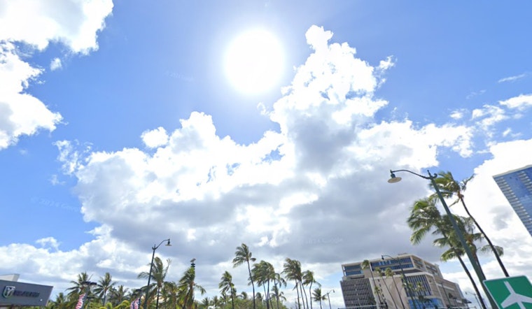
Residents in Honolulu can look forward to stable and relatively dry conditions today, with the forecast provided by the National Weather Service showing a continuation of these conditions across the state. It's all thanks to a deep-layer ridge that's been keeping the weather on an even keel, meaning we'll see the typical land and sea breeze regime that brings clouds and possibly a few brief showers in the afternoon, particularly over interior and leeward areas.
While the weather remains calm, NWS forecasters warn of an approaching cold front that could bring increased shower activity to Kauai and Oahu tomorrow, though minimal rainfall is expected. The rest of the state is forecast to remain dry. As the weekend approaches, another front is expected to brush past the islands. However, ensemble models suggest it will mostly bypass the area, bringing little rainfall but ushering in breezy easterly trades early next week.
In terms of aviation, the gentle breezes we're experiencing are creating ideal conditions for afternoon sea breezes. While satellite imagery showed a band of clouds and showers over the western islands earlier today, the NWS expects them to dissipate by this morning, keeping severe weather at bay. Therefore, we're forecasting mainly VFR (Visual Flight Rules) conditions, with isolated MVFR (Marginal Visual Flight Rules) possible under any passing showers later in the day.
Marine forecasts are seeing a relatively calm picture too, with the surface ridge overhead contributing to lighter winds, particularly over central waters — but don't let the serene winds fool you: swells from the northwest are poised to bring significant waves our way, and the NOAA buoys near Kauai have clocked in rather impressive numbers, so we're looking at surf advisories sprouting left and right; it's already led to a High Surf Warning in effect until tomorrow evening for several shores, and for good measure, a Small Craft Advisory will be riding those high waves until Friday evening.
When it comes to fire weather, the NWS has ruled out any critical conditions for the rest of the week, with low winds and rising moisture later in the week acting as a natural deterrent. So, while a cold front is approaching, it currently seems to be bringing more water than flames.


