Residents of San Diego and the surrounding areas can expect a continuation of warm and dry weather conditions through the week, with a slight cooling trend on the horizon. According to a forecast from NWS San Diego, today's high temperatures reached a comfortable range, with coastal areas hitting between 68 and 75 degrees and inland valleys warming up to 72 to 78 degrees. The trend is forecast to shift slightly as we move into Monday, with temperatures expected to drop by a couple of degrees.
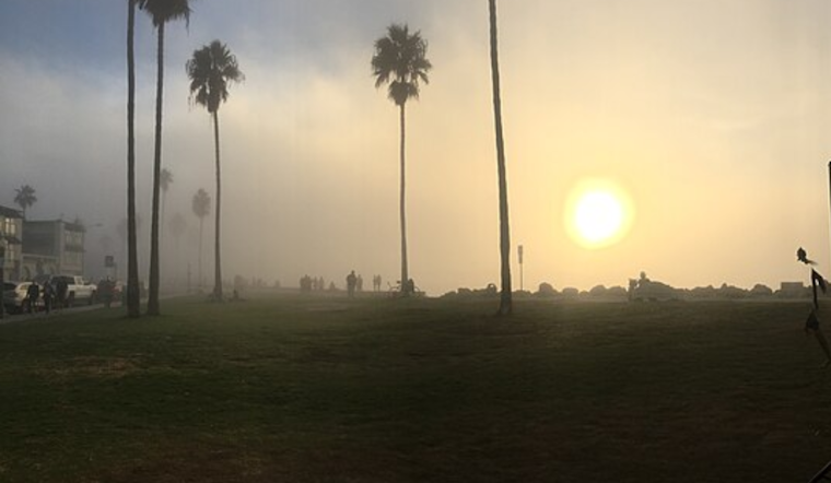
As we navigate through the early days of the week, the aforementioned cooling trend is set to intensify. "High temperatures will be a couple degrees lower on Monday," reports NWS San Diego, signaling residents to possibly dig out their lighter jackets and enjoy the cooler air. Come Tuesday, the marine layer is anticipated to drift in, carrying with it low clouds and fog along the coast, which could bring cooler temps and affect commute times during morning hours.
In a more detailed outlook provided by the Area Forecast Discussion from the National Weather Service San Diego, CA, the area is under the influence of high clouds, with a weak upper-level trough that brought minor cooling west of the mountains. Even though there has been a cooler shift, high temperatures remain above normal for this period. By mid-week, areas further inland can expect highs to dip about 5-10 degrees above the seasonal norm.
Visibility on the roads and at sea could get tricky, as patchy fog along the coast is expected to roll in during nights and mornings through Monday, expanding inland before Tuesday morning with "dense fog isn't out of the question along the coast Monday night into Tuesday morning," as per NWS San Diego's forecast. For mariners, this means being on the lookout for visibility dropping below 1 nautical mile at times. Staying cautious when navigating coastal waters during these periods of reduced visibility is sure to be advised.
A Beach Hazards Statement has been issued from Monday morning through Tuesday morning for various coastal areas in Orange and San Diego counties due to astronomical high tides that could lead to minor tidal overflow. This event is worth monitoring in susceptible spots like parking lots and low-lying beaches.
For those looking for a reprieve from the recent high temperatures, the coming days offer some respite, however slight. Looking beyond the fog and cooler air, Santa Ana winds are forecasted to pick up later in the week, potentially leading to more warming into the weekend. It seems the dance of the elements continues in a week that promises to be as dynamic as the region it touches.


