The Honolulu National Weather Service has provided an update on the state's weather conditions, indicating a turn to drier and more stable weather through the weekend following a cold front's transition into a trough. According to the NWS forecast, the Big Island witnessed some residual showers this morning, but the overall trend suggests a move towards typical trade wind patterns starting tomorrow night into Tuesday, with a focus of showers on windward and mauka areas.
Northerly winds and the resulting dry air have raised concerns about fire weather, especially this afternoon and tomorrow. However, since the winds are not expected to meet critical thresholds, the likelihood of such conditions remains low. An impending cold front, which could arrive midweek, poses uncertainty over its potential effects, as there is a difference in projections from various weather models. The Global Forecast System suggests a more "benign, progressive frontal passage," while the Euro model indicates a more "well-developed front."
For aviation interests, the dissipating front may still bring limited visibility and showers to the Big Island's north and east slopes, but improvements are forecasted by late morning. The AIRMET Sierra warning in effect for mountain obscuration is expected to be lifted as conditions clear up throughout the day. Marine conditions are somewhat unsettled, with scattered storms impacting far eastern offshore waters this morning, though these will also recede by the day's end, with building high pressure fortifying trade winds through early Tuesday.
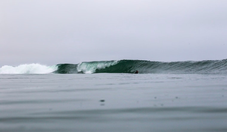
Surf conditions have also been under the spotlight, with a High Surf Warning in effect until 6 p.m. HST for several shores across the islands due to a declining large northwest swell. The Small Craft Advisory remains in place for affected water areas but is expected to be scaled back around Maui County and the Big Island by tomorrow, according to the National Weather Service report. The current south swell has peaked and is expected to taper off through the weekend, leading to calmer southern shores by next week.
Trade winds are forecast to strengthen surf on east-facing shores, potentially leading to rough conditions on tomorrow and Monday. As noted in the forecast, northeastern to eastern exposures may experience some effects from the large northwest swell passing through today. With these varied conditions, water enthusiasts and coastal communities should remain vigilant and heed local advisories for safety.


