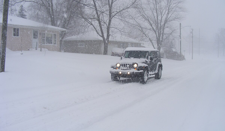
As winter grips Michigan with its icy hands, multiple school districts across the region have either delayed the start of Monday's classes or canceled them outright due to adverse weather conditions. The snow, which has been intermittent throughout the weekend, intensified, leading to these cautious measures.
Specifically, schools in parts of West Michigan have canceled classes for the day, including South Haven Public Schools and Covert Public Schools, as reported by WZZM13. Meanwhile, Montcalm County, Ionia County, and Van Buren County districts are also impacted. The worst is expected Monday evening into Tuesday morning, with lake-effect snow potentially bringing 1 to 3 inches, and some areas could see up to 6 inches.
Further confirming the day's disruptions, ABC12 reported that over a dozen Gratiot and Isabella counties school districts delayed openings due to slippery roads. Numerous other districts across Mid-Michigan have closed entirely. The light snow showers that dusted the region have set the stage for a deep freeze, with the potential for more lake effect snow showers thanks to persistent westerly winds.
Road conditions may not have seen major delays this morning, but drivers are urged to take extra time for their commutes. According to WNEM, today's high was at sunrise, around 25 degrees, with normal highs for this season around 30 degrees. By evening, temperatures are set to plummet into the teens, and gusty winds will make the wind chill dip into single digits. An occasional flurry tonight and more scattered snow showers Tuesday, with wind chills again reaching lower teens and single digits, are in the forecast.
Ice coverage on the Great Lakes has increased by 9.4% compared to last year's 2.36%. WNEM advises caution on Saginaw Bay, where ice conditions remain precarious, and echoes warnings for those heading out to fish to stay vigilant against thin ice and dangerous spots.


