Reflecting on six decades of transformation, the Metro Council's overview of regional land development offers a glimpse into how strategic planning and infrastructure shaped the Twin Cities area. The once predominantly undeveloped landscape of roughly 1.8 million acres has seen a rise in built-up areas to about 34%, sparing farming territories, parks, and preserved spaces from the sprawl of urbanization.
Factors such as the introduction of interstate highways have reconfigured the demographic distribution, pulling people and jobs out from Minneapolis and Saint Paul into suburban territories. "This suburbanization of jobs allowed more people to live in more places," Met Council principal researcher Todd Graham said in an statement released by Metropolitant Council, highlighting both the benefits and implications of such infrastructural developments.
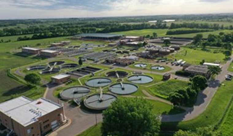
Alongside this, affordable sewer policies have been significant in sculpting the region's development, ensuring that household wastewater costs remain below the national average by approximately 35%. A cost-efficient approach to the provision of urban services has been pivotal, and the outcome of this pragmatic growth is seen today in the lower sewer rates benefitting the local communities.
In recent years, a shift has been observed in housing preferences, with a notable inclination towards apartment living in urban cores, as per data from the Met Council. The impact is clear: a reduction in land consumption, with land usage in the 2010s being half of what it was in the 1990s. Contributing to this trend, the Met Council's Livable Communities grants have enabled an increase in the development of affordable housing and properties along transit corridors, promoting a lifestyle less dependent on automobiles.
Looking ahead, the Met Council is armed with the task of forecasting regional growth up to 2050, a foundational element for comprehensive local planning. With public input gathered and the adoption of the "Imagine 2025" guide on the horizon, this effort marks an important step in steering future development. The upcoming Generalized Land Use Inventory, scheduled for completion in 2026, will provide further insights into the success of present policies and shape the strategies for years to come.


